
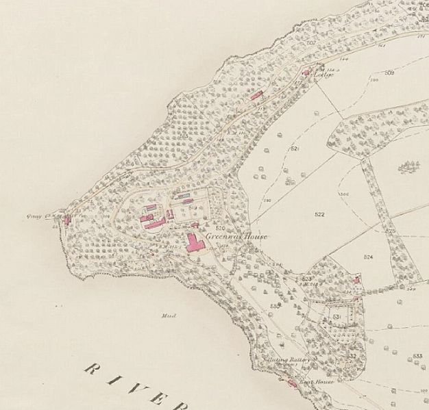
Image: Ordnance Survey map of Devon, 1854, showing the Greenway Estate

Size of this preview: 626 × 599 pixels. Other resolutions: 251 × 240 pixels | 1,344 × 1,287 pixels.
Original image (1,344 × 1,287 pixels, file size: 297 KB, MIME type: image/jpeg)
Description: Ordnance Survey map of Devon, 1854, showing the Greenway Estate
Title: Ordnance Survey map of Devon, 1854, showing the Greenway Estate
Credit: National Library of Scotland
Author: Ordnance Survey
Usage Terms: Open Government License version 1.0
License: OGL v1.0
License Link: http://NationalArchives.gov.uk/doc/open-government-licence/version/1/
Attribution Required?: Yes
Image usage
The following page links to this image:

All content from Kiddle encyclopedia articles (including the article images and facts) can be freely used under Attribution-ShareAlike license, unless stated otherwise.