
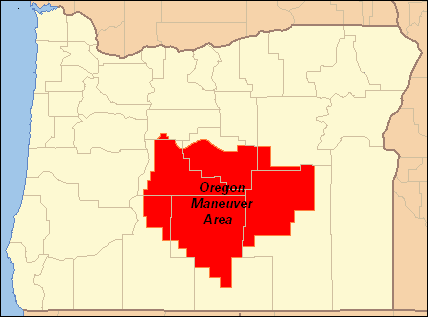
Image: Oregon Maneuver Area, 1943
No higher resolution available.
Oregon_Maneuver_Area,_1943.PNG (428 × 317 pixels, file size: 5 KB, MIME type: image/png)
Description: Map showing the area used by the United States Army for the Oregon Maneuver, a World War II training exercise conducted in central Oregon in 1943; the maneuver area covers much of Crook, Deschutes, Harney, Klamath, and Lake counties plus small parts of Jefferson and Grant counties
Title: Oregon Maneuver Area, 1943
Credit: I created this work myself using as map format from Wiki-Commons
Author: Orygun
Permission: Public Domain; map is based on a United States Government work modified and licensed under GNU Free Documentation License by Ruhrfisch
Usage Terms: Public domain
License: Public domain
Attribution Required?: No
Image usage
The following page links to this image:

All content from Kiddle encyclopedia articles (including the article images and facts) can be freely used under Attribution-ShareAlike license, unless stated otherwise.