Image: Osetia Południowa

Size of this preview: 652 × 600 pixels. Other resolutions: 261 × 240 pixels | 2,681 × 2,466 pixels.
Original image (2,681 × 2,466 pixels, file size: 8.78 MB, MIME type: image/png)
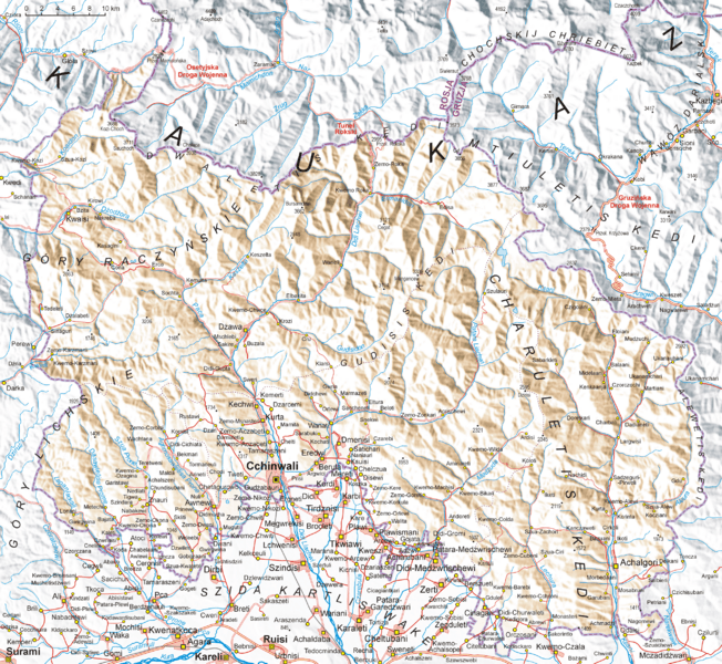
Description: Map of South Ossetia, based on Soviet topographic map published in the eighties and Shuttle Radar Topography Mission (STRM). Names are in Polish transcription based on rules of Commission on Standardization of Geographical Names Outside the Republic of Poland. Differences between Polish transcription and English one: C=TS, CH=KH, CZ=CH, DŻ=J, J=Y, Ł=W, SZ=SH, W=V (i.e.: CCHINWALI=TSKHINVALI, MCZADIDŻWARI=MCHADIJVARI, SZUA-CIRI=SHUA-TSIRI etc.)
Title: Osetia Południowa
Credit: Own work
Author: Aotearoa
Usage Terms: Creative Commons Attribution-Share Alike 3.0
License: CC-BY-SA-3.0
License Link: http://creativecommons.org/licenses/by-sa/3.0/
Attribution Required?: Yes
Image usage
The following page links to this image:

All content from Kiddle encyclopedia articles (including the article images and facts) can be freely used under Attribution-ShareAlike license, unless stated otherwise.
