
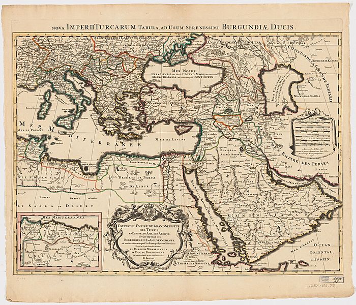
Image: Ottoman Empire 1600 by Jaillot

Size of this preview: 700 × 600 pixels. Other resolutions: 280 × 240 pixels | 2,399 × 2,055 pixels.
Original image (2,399 × 2,055 pixels, file size: 1.18 MB, MIME type: image/jpeg)
Description: Map of Ottoman Empire and its divisions in 1696
Title: Ottoman Empire 1696 by Jaillot
Credit: H. Iaillot: Estats de l'empire du Grand Seigneur des Turcs, en Europe, en Asia, et en Afrique, divisé en tous ses Beglerbeglicz, ou gouvernments. Paris, 1696. MAP-LC G7430 1696 .J3. 1 map : hand col. ; 44 x 60 cm. Scale [ca. 1:10,000,000]. Harvard Map Collection, Harvard University, Cambridge, Mass.
Author: Alexis Hubert Jaillot
Usage Terms: Public domain
License: Public domain
Attribution Required?: No
Image usage
The following page links to this image:

All content from Kiddle encyclopedia articles (including the article images and facts) can be freely used under Attribution-ShareAlike license, unless stated otherwise.