
Image: Otus mayottensis map

Size of this PNG preview of this SVG file: 477 × 599 pixels. Other resolution: 191 × 240 pixels.
Original image (SVG file, nominally 1,033 × 1,297 pixels, file size: 520 KB)
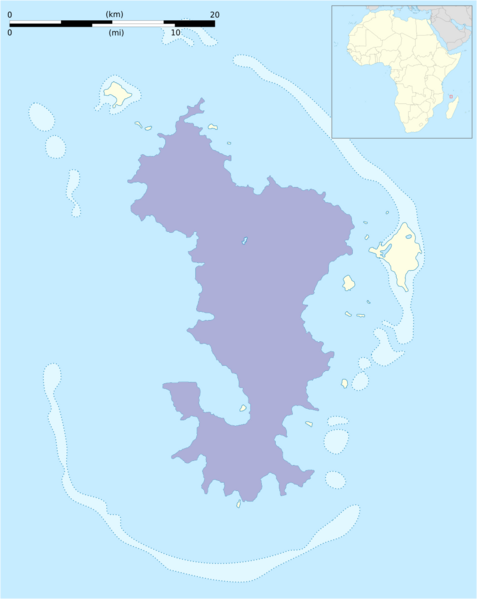
Description: Approximate range of Otus mayottensis based on: BirdLife International. 2016. Otus mayottensis. The IUCN Red List of Threatened Species 2016: e.T22732599A95047769. https://dx.doi.org/10.2305/IUCN.UK.2016-3.RLTS.T22732599A95047769.en. Downloaded on 25 September 2021. Depicted: Mayotte Island, Eastern Africa Year-round
Title: Otus mayottensis map
Credit: This file was derived from: Mayotte blank map.svg This file was derived from: Africa location map.svg
Author: Jebbles
Usage Terms: Creative Commons Attribution-Share Alike 3.0
License: CC BY-SA 3.0
License Link: https://creativecommons.org/licenses/by-sa/3.0
Attribution Required?: Yes
Image usage
The following page links to this image:

All content from Kiddle encyclopedia articles (including the article images and facts) can be freely used under Attribution-ShareAlike license, unless stated otherwise.