
Image: P. bastardi clade range map
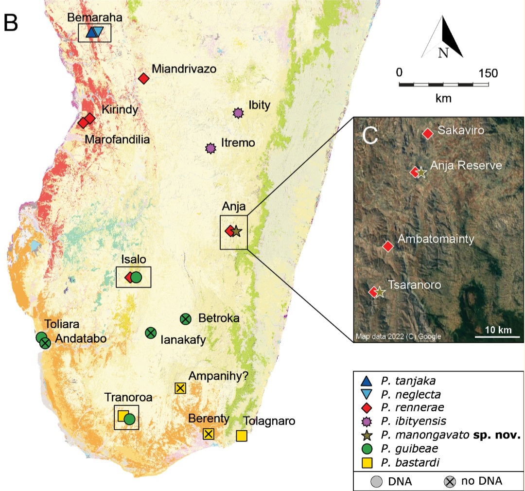
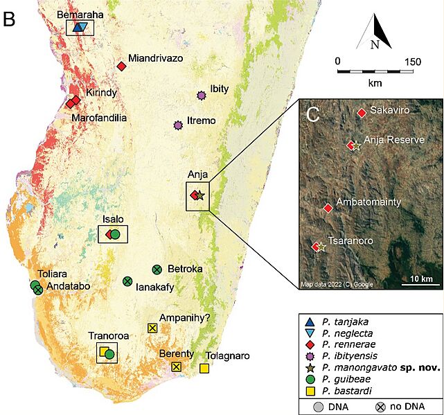
Description: B: distribution of the different species within the P. bastardi clade, updated from Miralles et al. (2021) by adding Itremo for P. ibityensis (FGMV 2001-D37) and Ianakafy for P. guibeae (FMNH 73059). The exact geographic position of Ampanihy remains uncertain. Species symbol colours match the colours of the phylogenetic trees and haplotype networks. Black rectangles highlight localities with sympatric lineages. The map shows the remaining primary vegetation of Madagascar (https://kew.iro.bl.uk/): evergreen humid forest (green), deciduous dry forest (red), spiny arid forest (orange), tapia forest (yellow), western sub-humid forest (blue), mangroves (purple), cultivation (pink) and south western coastal bushland (grey) C: satellite image with new records of P. rennerae and P. manongavato sp. nov. in the area south of Ambalavao.
Title: P. bastardi clade range map
Credit: https://doi.org/10.3897/zookeys.1181.108134 (license)
Author: Costanza Piccoli, Francesco Belluardo, Javier Lobón-Rovira, Ivo Oliveira Alves, Malalatiana Rasoazanany, Franco Andreone, Gonçalo M. Rosa, Angelica Crottini
Usage Terms: Creative Commons Attribution-Share Alike 4.0
License: CC BY-SA 4.0
License Link: https://creativecommons.org/licenses/by-sa/4.0
Attribution Required?: Yes
Image usage
The following 2 pages link to this image:
