
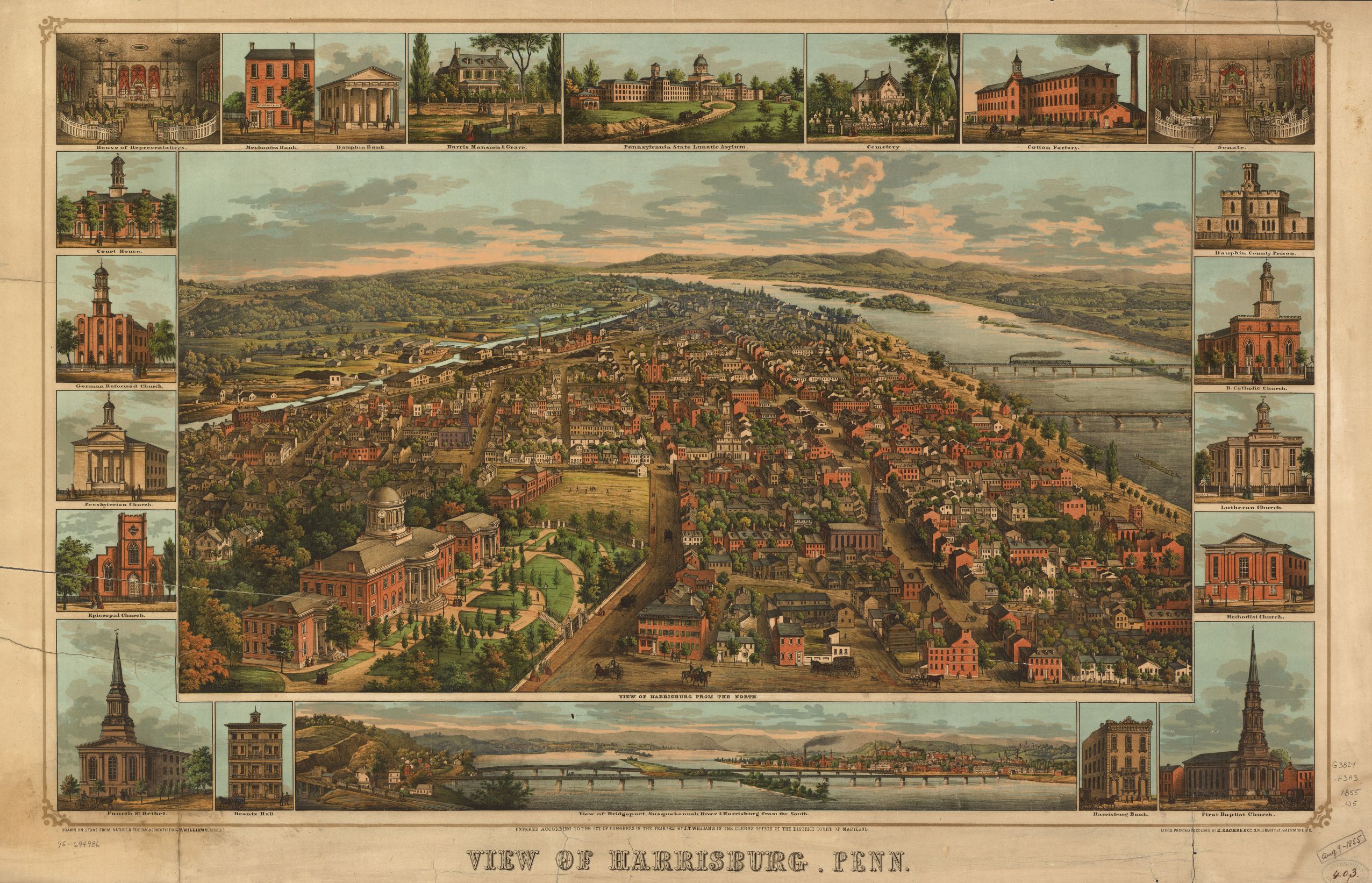
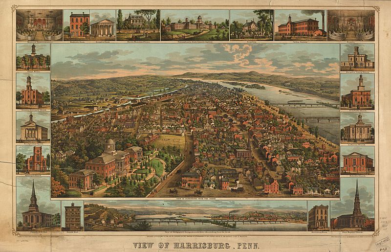
Image: PA Harrisburg 1855 Map
Description: A map of Harrisburg, Pennsylvania made sometime in 1855.
Title: PA Harrisburg 1855 Map
Credit: This map is available from the United States Library of Congress's Geography & Map Division under the digital ID g3824h.pm007880. This tag does not indicate the copyright status of the attached work. A normal copyright tag is still required. See Commons:Licensing for more information. العربية | čeština | Deutsch | English | español | فارسی | suomi | français | magyar | italiano | македонски | മലയാളം | Nederlands | polski | português | русский | slovenčina | slovenščina | Türkçe | українська | 中文 | 中文(简体) | 中文(繁體) | +/−
Author: J. Thomas Williams
Permission: This work is in the public domain in the United States because it was published (or registered with the U.S. Copyright Office) before January 1, 1923. Public domain works must be out of copyright in both the United States and in the source country of the work in order to be hosted on the Commons. If the work is not a U.S. work, the file must have an additional copyright tag indicating the copyright status in the source country. PD-1923 Public domain in the United States //commons.wikimedia.org/wiki/File:PA_Harrisburg_1855_Map.jpg
Usage Terms: Public domain
License: Public domain
Attribution Required?: No
Image usage
The following page links to this image:
