
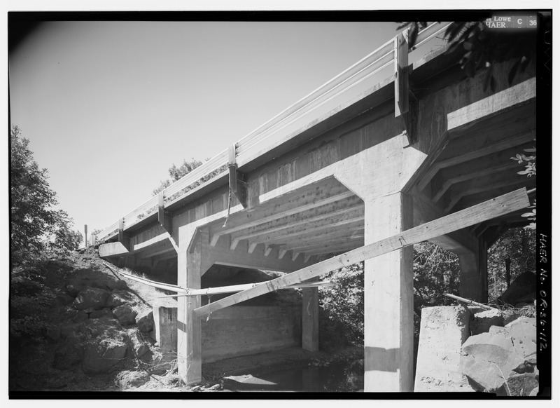
Image: PERSPECTIVE ELEVATION LOOKING SOUTHEAST AT CHENOWETH CREEK BRIDGE. INSULATED POWERLINE STRUNG ACROSS FRONT. - Historic Columbia River Highway, Troutdale, Multnomah County, OR HAER ORE,26-TROUT.V,1-112
Size of this JPG preview of this TIF file: 800 × 582 pixels. Other resolution: 320 × 233 pixels.
Original image (5,000 × 3,638 pixels, file size: 17.35 MB, MIME type: image/tiff)
Title: PERSPECTIVE ELEVATION LOOKING SOUTHEAST AT CHENOWETH CREEK BRIDGE. INSULATED POWERLINE STRUNG ACROSS FRONT. - Historic Columbia River Highway, Troutdale, Multnomah County, OR
Credit: https://www.loc.gov/pictures/item/or0386.photos.354763p
Permission: Public domainPublic domainfalsefalse This image or media file contains material based on a work of a National Park Service employee, created as part of that person's official duties. As a work of the U.S. federal government, such work is in the public domain in the United States. See the NPS website and NPS copyright policy for more information.
Usage Terms: Public domain
License: Public domain
Attribution Required?: No
Image usage
The following page links to this image:

All content from Kiddle encyclopedia articles (including the article images and facts) can be freely used under Attribution-ShareAlike license, unless stated otherwise.