
Image: PIA02035 Map of Mars' Topography
Size of this preview: 800 × 510 pixels. Other resolutions: 320 × 204 pixels | 2,761 × 1,759 pixels.
Original image (2,761 × 1,759 pixels, file size: 1.06 MB, MIME type: image/jpeg)
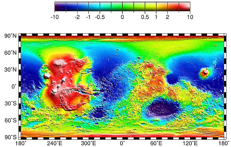
Description: Map of Mars' topography with zonal spherical harmonic degree 1 (COM/COF offset along the polar z-axis) removed. The projection is rectangular to show topography from pole to pole. Note the general similarity in elevation between the northern and southern hemispheres. The figure highlights the two other significant components of martian topography: the Tharsis province and the Hellas impact basin. Here we have not removed shorter-wavelength topographic features, including those comprising the dichotomy boundary scarp.
Usage Terms: Public domain
Image usage
The following page links to this image:

All content from Kiddle encyclopedia articles (including the article images and facts) can be freely used under Attribution-ShareAlike license, unless stated otherwise.