
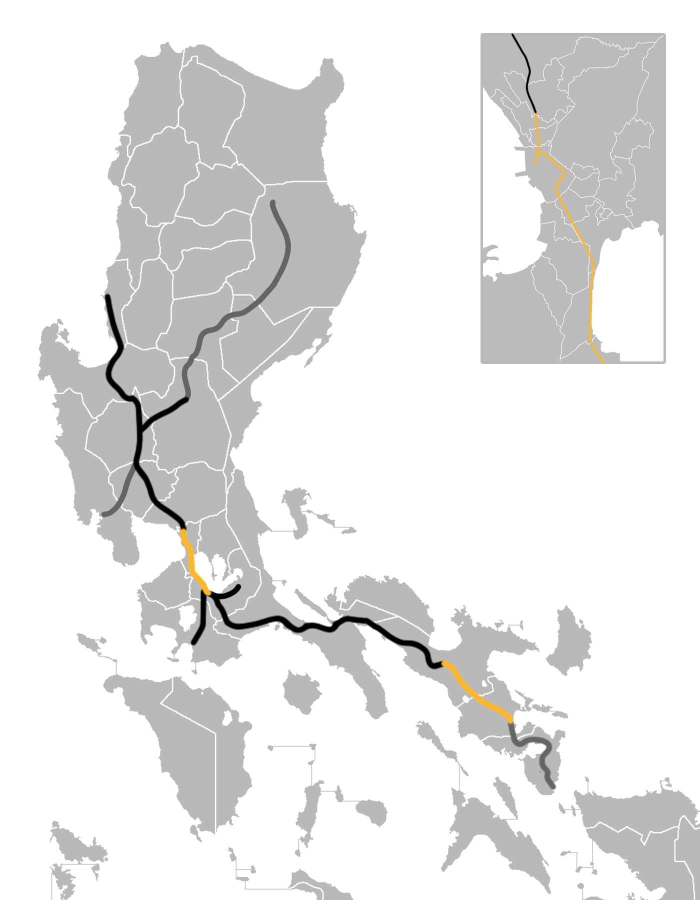
Image: PNR North and South map
Size of this preview: 466 × 599 pixels. Other resolutions: 187 × 240 pixels | 1,400 × 1,800 pixels.
Original image (1,400 × 1,800 pixels, file size: 171 KB, MIME type: image/png)
Description: A map of thePhilippine National Railways network, which includes active (orange), inactive (black), and proposed (gray) lines. Based on the following maps: File:Philippine National Railways.png File:PNR South Long Haul Map.png File:PNR Luzon Railways Program.png en:File:Philippine railways during its peak.jpg File:Philippine National Railways Route Map.jpg
Title: PNR North and South map
Credit: Own work
Author: Itsquietuptown
Usage Terms: Creative Commons Attribution-Share Alike 4.0
License: CC BY-SA 4.0
License Link: https://creativecommons.org/licenses/by-sa/4.0
Attribution Required?: Yes
Image usage
The following page links to this image:

All content from Kiddle encyclopedia articles (including the article images and facts) can be freely used under Attribution-ShareAlike license, unless stated otherwise.