
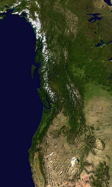
Image: PacNW satellite

Size of this preview: 358 × 599 pixels. Other resolutions: 143 × 240 pixels | 442 × 739 pixels.
Original image (442 × 739 pixels, file size: 58 KB, MIME type: image/jpeg)
Description: Satellite image of the Pacific Northwest region of North America
Title: PacNW satellite
Credit: Cropped from en:Image:North_America_satellite_orthographic.jpg
Author: The original uploader was SebastianHelm at English Wikipedia
Usage Terms: Public domain
License: Public domain
Attribution Required?: No
Image usage
There are no pages that link to this image.

All content from Kiddle encyclopedia articles (including the article images and facts) can be freely used under Attribution-ShareAlike license, unless stated otherwise.