
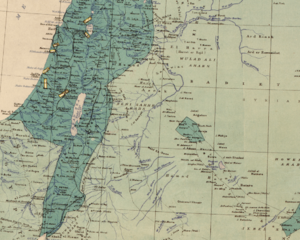
Image: Palestine and Transjordan in Maunsell's map, Pre-World War I British Ethnographical Map of eastern Turkey in Asia, Syria and western Persia 05

Size of this preview: 748 × 600 pixels. Other resolutions: 300 × 240 pixels | 1,028 × 824 pixels.
Original image (1,028 × 824 pixels, file size: 736 KB, MIME type: image/png)
Description: Palestine and Transjordan in Maunsell's map, Pre-World War I British Ethnographical Map of eastern Turkey in Asia, Syria and western Persia
Title: Palestine and Transjordan in Maunsell's map, Pre-World War I British Ethnographical Map of eastern Turkey in Asia, Syria and western Persia 05
Credit: This file has been extracted from another file
Author: UK Government
Usage Terms: Public domain
License: Public domain
Attribution Required?: No
Image usage
The following page links to this image:

All content from Kiddle encyclopedia articles (including the article images and facts) can be freely used under Attribution-ShareAlike license, unless stated otherwise.