
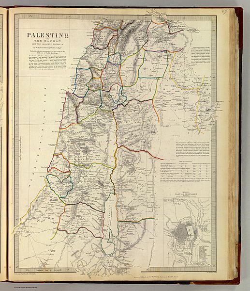
Image: Palestine with the Hauran and the adjacent districts, William Hughes 1843

Size of this preview: 517 × 600 pixels. Other resolutions: 207 × 240 pixels | 6,162 × 7,150 pixels.
Original image (6,162 × 7,150 pixels, file size: 8.6 MB, MIME type: image/jpeg)
Description: Palestine with the Hauran and the adjacent districts By W. Hughes, Prof. Geogr(aph)y, Coll. for Civ. Engrs. (with) Modern plan of Jerusalem. Published under the superintendence of the Society for the Diffusion of Useful Knowledge. (Engraved by) W. Hughes, 1843. London, published April 15th. 1843 by Chapman & Hall, 186, Strand (1844)
Title: Palestine with the Hauran and the adjacent districts, William Hughes 1843
Credit: http://www.davidrumsey.com/maps4522.html
Author: w:William Hughes (geographer)
Usage Terms: Public domain
License: Public domain
Attribution Required?: No
Image usage
The following page links to this image:

All content from Kiddle encyclopedia articles (including the article images and facts) can be freely used under Attribution-ShareAlike license, unless stated otherwise.