
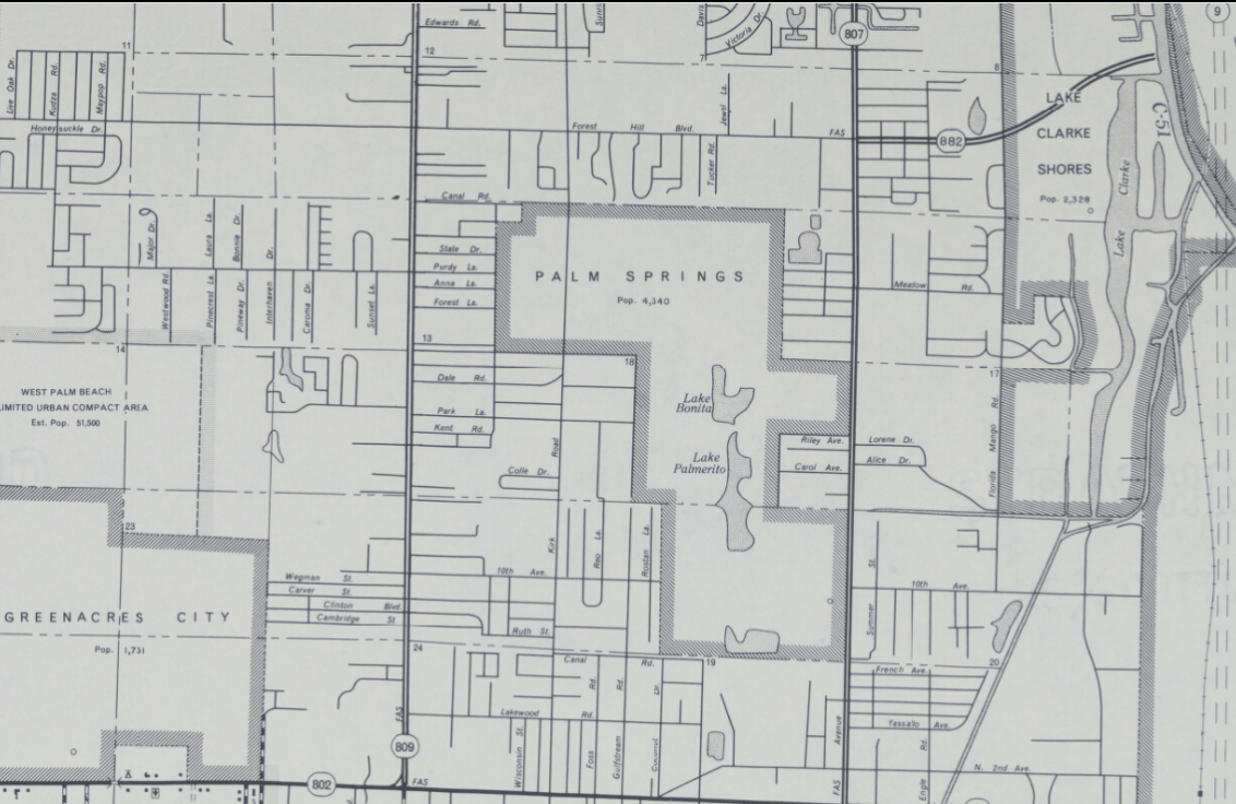
Image: Palm Springs, Florida, 1968 FDOT map
Size of this preview: 800 × 520 pixels. Other resolutions: 320 × 208 pixels | 1,132 × 736 pixels.
Original image (1,132 × 736 pixels, file size: 645 KB, MIME type: image/png)
Description: A June 1968 FDOT map showing the boundaries of Palm Springs, Florida, which has since undergone several expansions via annexation. Found inside the General Highway Map for Palm Beach County (image 19): https://ufdc.ufl.edu/UF00016492/00001/citation
Title: Palm Springs, Florida, 1968 FDOT map
Credit: https://ufdc.ufl.edu/UF00016492/00001/zoom/18
Author: Florida Department of Transportation
Usage Terms: Public domain
License: Public domain
Attribution Required?: No
Image usage
The following page links to this image:

All content from Kiddle encyclopedia articles (including the article images and facts) can be freely used under Attribution-ShareAlike license, unless stated otherwise.