
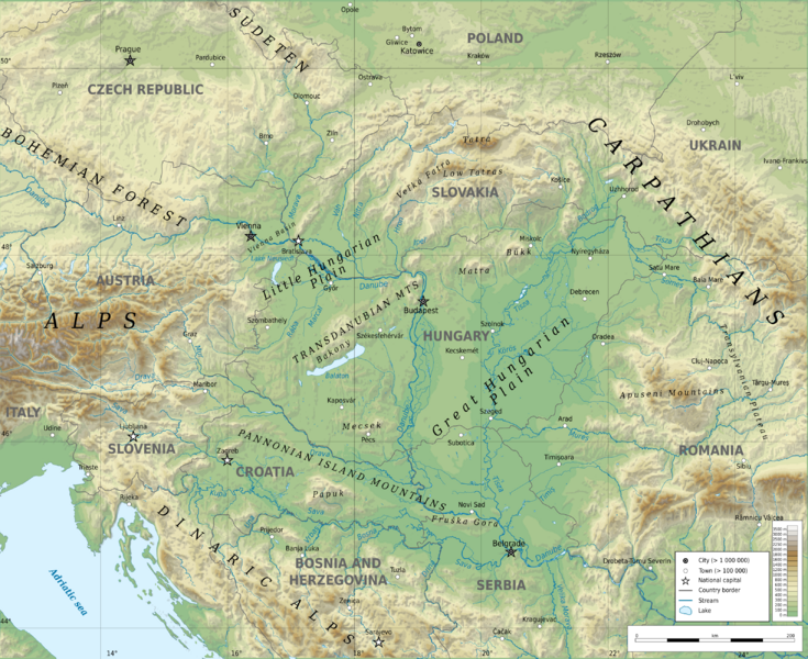
Image: Pannonian Basin geographic map

Description: Geographic map of Pannonian Basin. Limits of the map:
Title: Pannonian Basin geographic map
Credit: Own work Sources of data: Topography: ETOPO1 (public domain); Rivers and water: Produced using Copernicus data and information funded by the European Union - EU-Hydro layers Other data: © OpenStreetMap contributors; Tool: The map is created with Octave scripts developed by Ikonact
Author: Ikonact
Permission: Any use of this map is subject of the license(s) stated below with the condition that you credit (Wikimedia Commons user: Ikonact) as the author . A message with a reply address would also be greatly appreciated.
Usage Terms: Creative Commons Attribution-Share Alike 4.0
License: CC BY-SA 4.0
License Link: https://creativecommons.org/licenses/by-sa/4.0
Attribution Required?: Yes
Image usage
The following page links to this image:
