
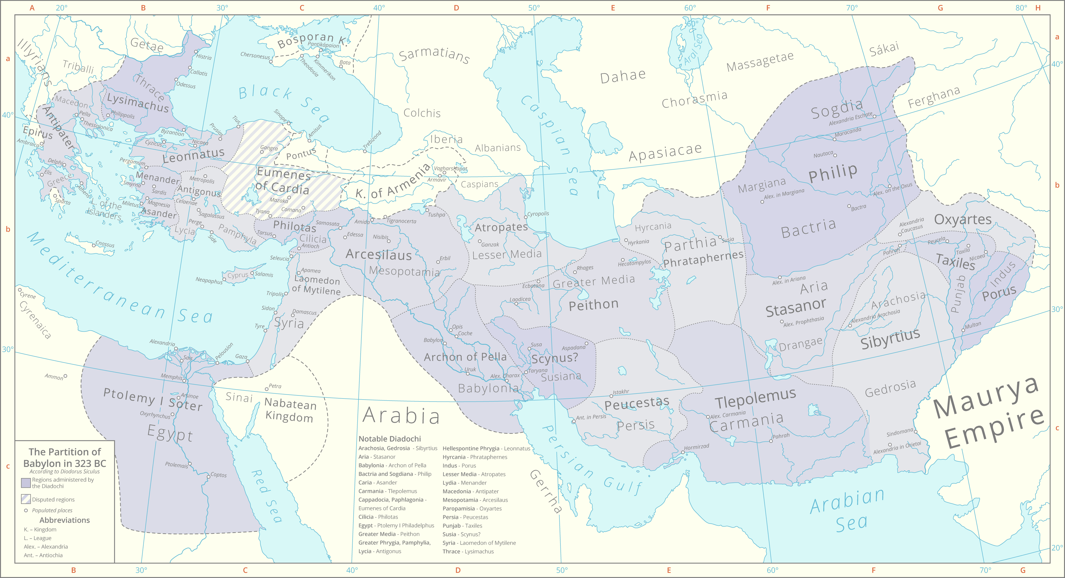
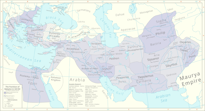
Image: Partition of Babylon 323 BC
Size of this preview: 800 × 434 pixels. Other resolutions: 320 × 174 pixels | 4,093 × 2,222 pixels.
Original image (4,093 × 2,222 pixels, file size: 758 KB, MIME type: image/png)
Description: This map details the division of Alexander's Empire as per the Partition of Babylon in 323 BC according to the historian Diodorus Siculus. Historical lakes and coastlines are derived from the Ancient World Mapping Center [1]. The boundaries of the peripheral kingdoms are based on these maps File:Bosporan Kingdom growth map-en.svg File:Hellenistic world and Maurya Empire 281 BCE.png
Title: Partition of Babylon 323 BC
Credit: Own work
Author: Cattette
Usage Terms: Creative Commons Attribution 4.0
License: CC BY 4.0
License Link: https://creativecommons.org/licenses/by/4.0
Attribution Required?: Yes
Image usage
The following page links to this image:

All content from Kiddle encyclopedia articles (including the article images and facts) can be freely used under Attribution-ShareAlike license, unless stated otherwise.