
Image: Peel-Commission Report Map1 AdminDistrictsSyriaPalestine 1154x1846
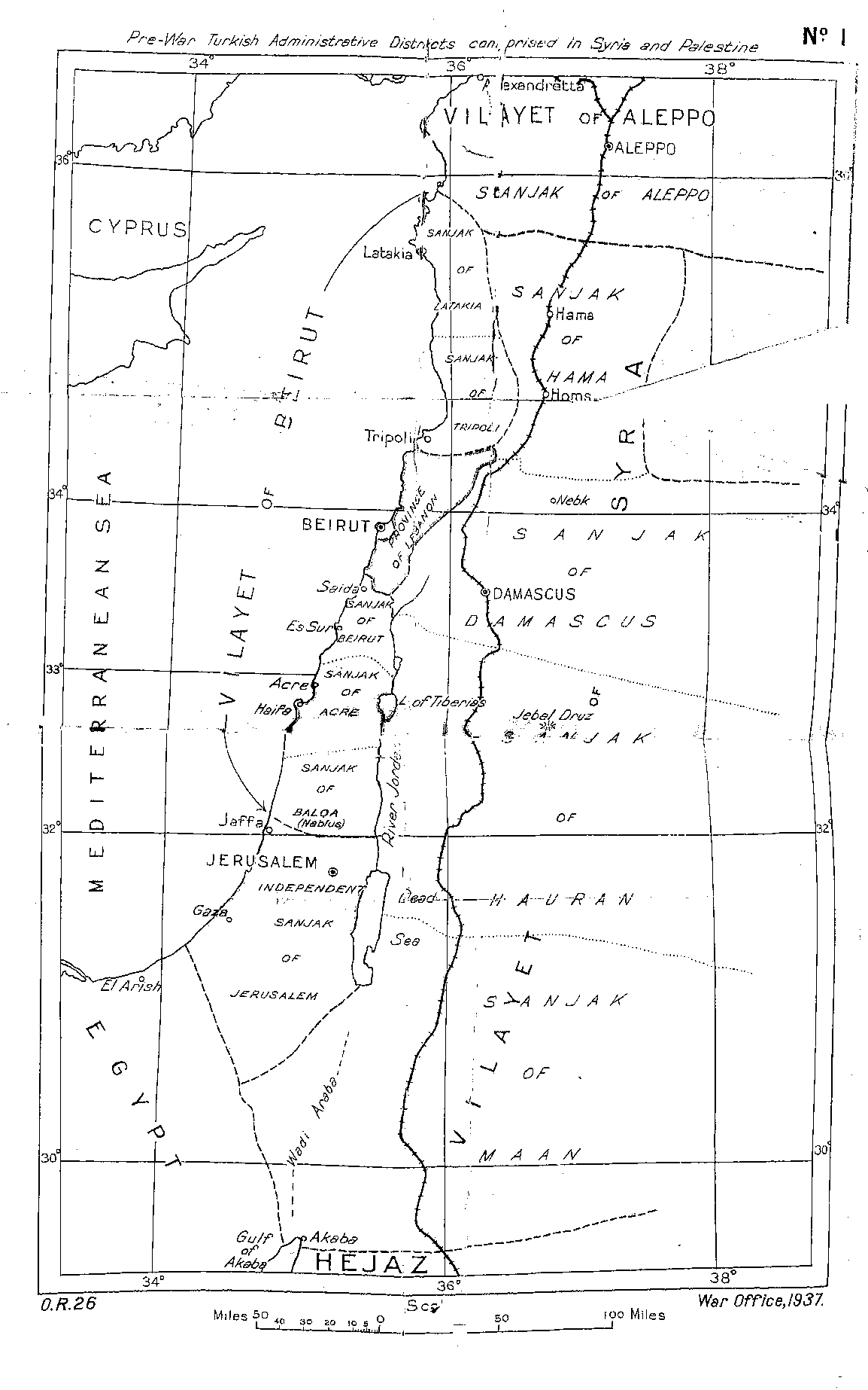
Description: Pre-war Turkish Administrative Districts comprised in Syria and Palestine. Map No. 1 of the Peel Commission Report, presented to illustrate the Vilayets and Sandjaks mentioned in the 1915-10-24 en:McMahon Letters (McMahon Pledge, see also en:McMahon–Hussein Correspondence), showing the Ottoman adminstrative divisions. This is the original scan from the scanned copy of the Peel Report as found on the UNISPAL library of the United Nations.
Title: Peel-Commission Report Map1 AdminDistrictsSyriaPalestine 1154x1846
Credit: Palestine Royal Commission (Peel Commission), Report, Presented by the Secretary of State for the Colonies to Parliament by Command of His Majesty, July 1937. London, His Majesty's Stationary Office, 1937 Download as PDF from UNISPAL:UN.ORG
Author: British War Office, 1937
Permission: This work created by the United Kingdom Government is in the public domain. This is because it is one of the following: It is a photograph taken prior to 1 June 1957; or It was published prior to 1973; or It is an artistic work other than a photograph or engraving (e.g. a painting) which was created prior to 1973.HMSO has declared that the expiry of Crown Copyrights applies worldwide (ref: HMSO Email Reply) More information. See also Copyright and Crown copyright artistic works.
Usage Terms: Public domain
License: Public domain
Attribution Required?: No
Image usage
The following page links to this image:
