
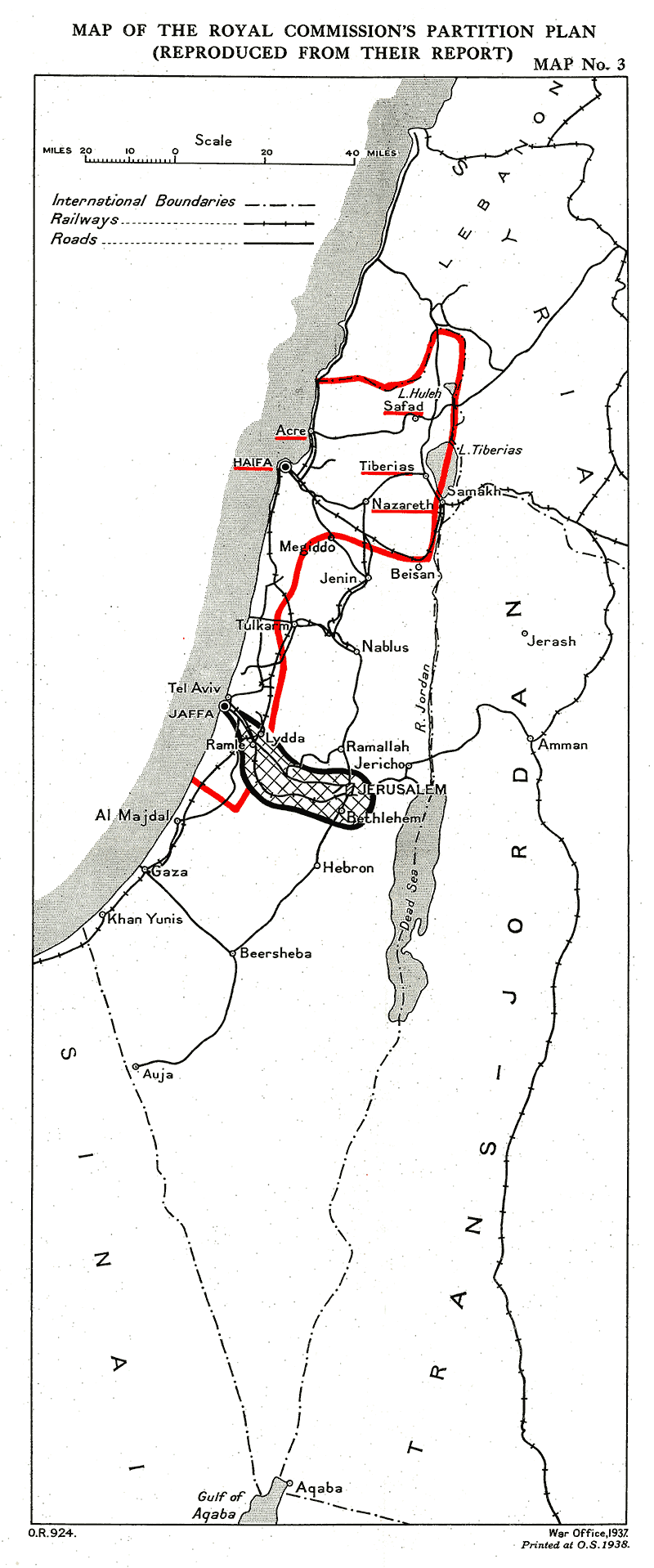
Image: PeelMap
Size of this preview: 250 × 599 pixels. Other resolutions: 100 × 240 pixels | 800 × 1,918 pixels.
Original image (800 × 1,918 pixels, file size: 116 KB, MIME type: image/png)
Description: Provisional frontiers of the Palestine partition according to the Palestine Royal Commission (Peel report)
Title: PeelMap
Credit: Palestine Partition Committee report 1938
Author: UK Government
Usage Terms: Public domain
License: Public domain
Attribution Required?: No
Image usage
The following page links to this image:

All content from Kiddle encyclopedia articles (including the article images and facts) can be freely used under Attribution-ShareAlike license, unless stated otherwise.