
Image: Pennsylvania and Ohio Canal map
Size of this preview: 560 × 600 pixels. Other resolutions: 224 × 240 pixels | 1,242 × 1,330 pixels.
Original image (1,242 × 1,330 pixels, file size: 319 KB, MIME type: image/jpeg)
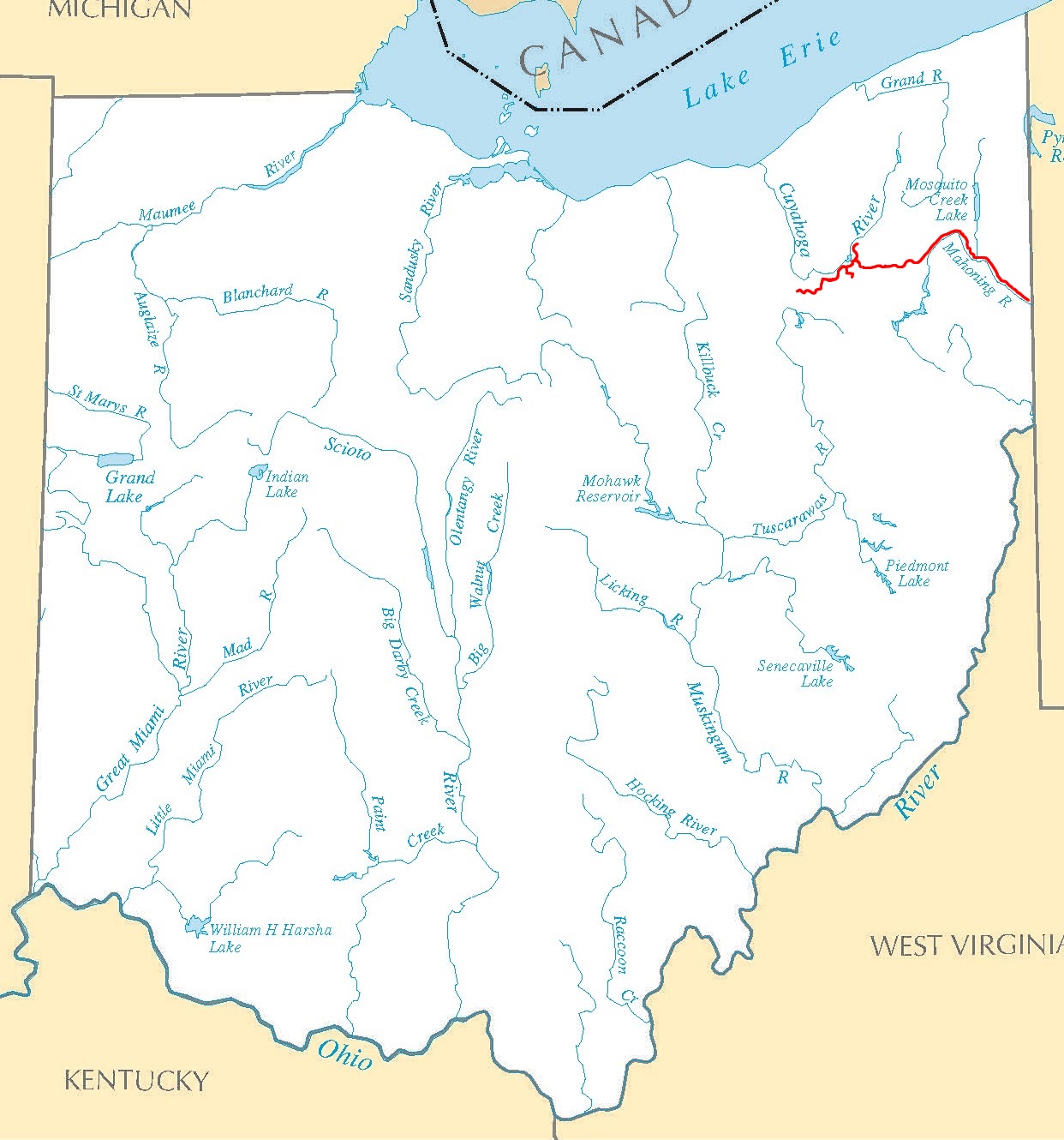
Description: Map of the Pennsylvania and Ohio Canal (pictured in red) in Ohio in the United States. The canal linked the Ohio and Erie Canal and the Pennsylvania Canal.
Title: Pennsylvania and Ohio Canal map
Credit: https://www.flickr.com/photos/timevanson/44185841661/
Author: Tim Evanson
Usage Terms: Creative Commons Attribution-Share Alike 2.0
License: CC BY-SA 2.0
License Link: https://creativecommons.org/licenses/by-sa/2.0
Attribution Required?: Yes
Image usage
The following page links to this image:

All content from Kiddle encyclopedia articles (including the article images and facts) can be freely used under Attribution-ShareAlike license, unless stated otherwise.