
Image: PenobscotExpedition1779
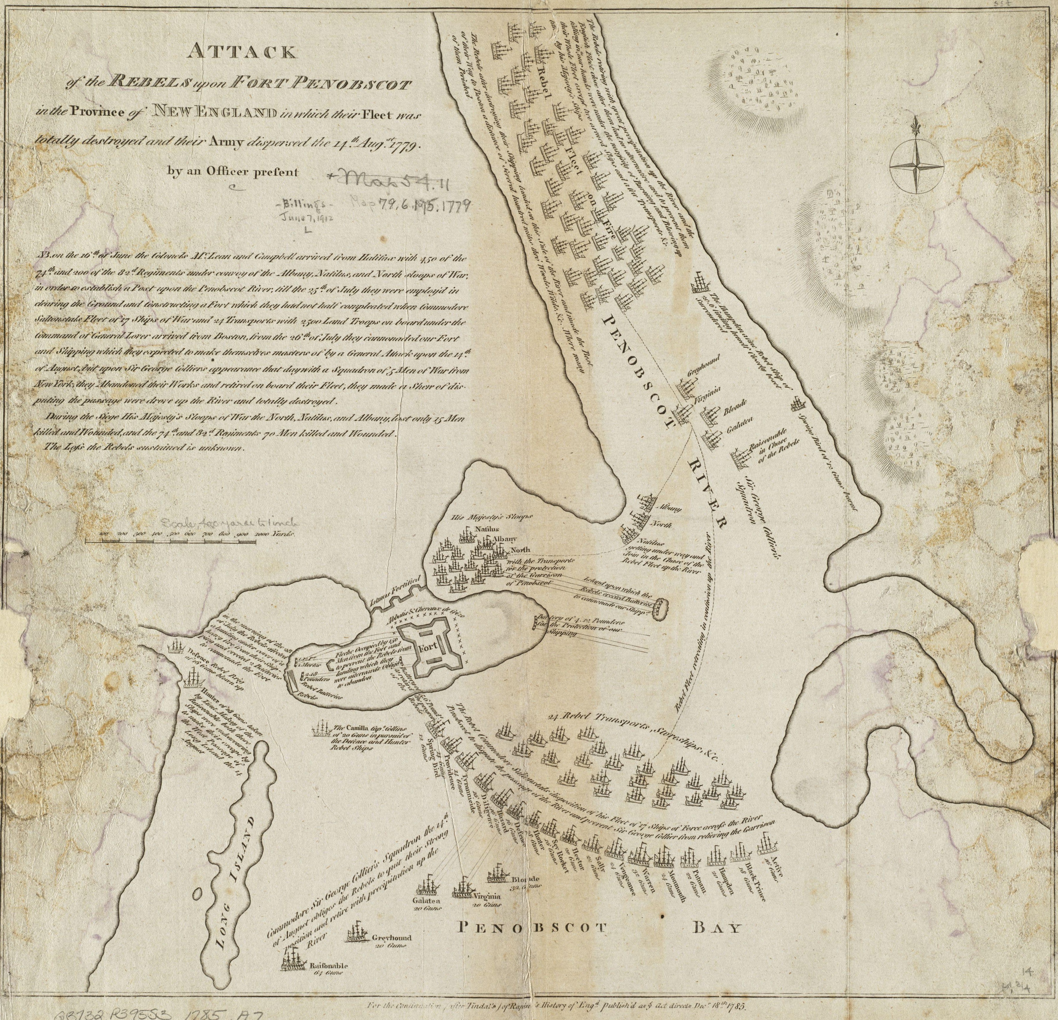
Description: This 1785 map depicts the 1779 naval action of the Penobscot Expedition. The original map measures 36.0x38.0 cm. The map is in mirror image to the actual geography; the Penobscot River is actually to the peninsula's west. The caption reads: "Attack of the rebels upon Fort Penobscot in the province of New England in which their fleet was totally destroyed and their Army dispersed the 14th Augst. 1779"
Title: PenobscotExpedition1779
Credit: This map is from the Norman B. Leventhal Map Center at the Boston Public Library. Url at the time of upload: http://maps.bpl.org/details_10803/ Call Number: G3732.P395S3 1785 .A7
Author: Unknown authorUnknown author
Usage Terms: Public domain
License: Public domain
Attribution Required?: No
Image usage
The following 3 pages link to this image:
