
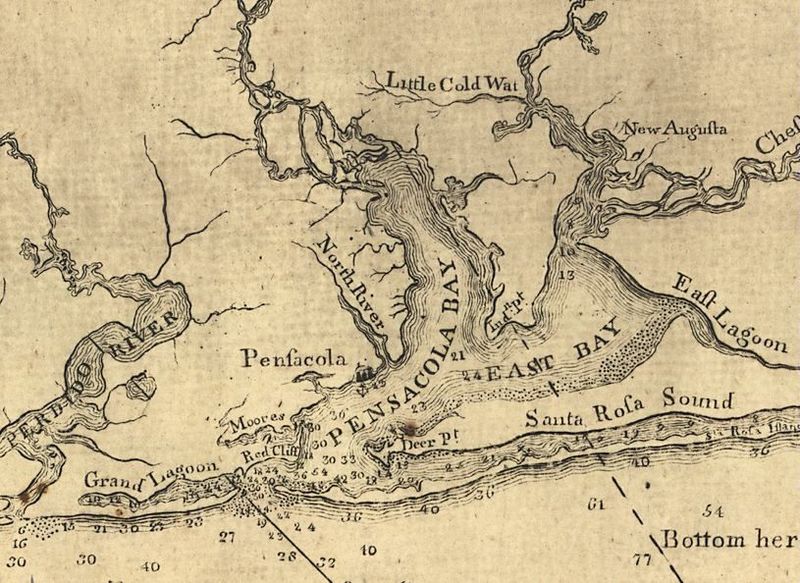
Image: PensacolaBay1781

Size of this preview: 800 × 583 pixels. Other resolutions: 320 × 233 pixels | 815 × 594 pixels.
Original image (815 × 594 pixels, file size: 136 KB, MIME type: image/jpeg)
Description: Image is of a map of Pensacola Bay made by a British team in 1781.
Title: PensacolaBay1781
Credit: Map made by the British Empire, 1781
Author: United Kingdom of Great Britain, 1781
Usage Terms: Public domain
License: Public domain
Attribution Required?: No
Image usage
The following page links to this image:

All content from Kiddle encyclopedia articles (including the article images and facts) can be freely used under Attribution-ShareAlike license, unless stated otherwise.