
Image: Perth Town Walls Plan

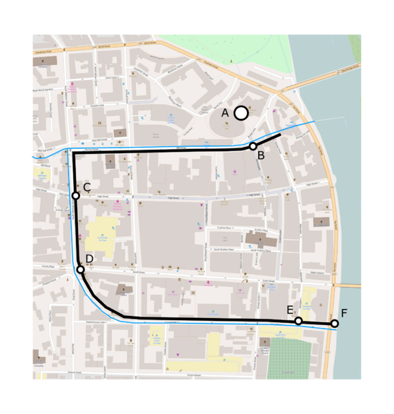
Description: An indicative plan showing the medieval walls around Perth, Scotland. The walls followed present day Murray Street, South Methven Street, Canal Crescent and Canal Street. No part of the wall is still standing. The blue line marks the mill lade/ditches. The positions of gates (ports) and towers are marked including: (A) the site of Perth Castle; (B) Red Brig Port; (C) Turret Brig Port; (D) South Street Port; (E) Spey Tower; (F) Monk's Tower.
Title: Perth Town Walls Plan
Credit: Own work
Author: What Are The Civilian Applications?
Usage Terms: Creative Commons Attribution-Share Alike 4.0
License: CC BY-SA 4.0
License Link: https://creativecommons.org/licenses/by-sa/4.0
Attribution Required?: Yes
Image usage
The following page links to this image:
