
Image: Petun map

Size of this PNG preview of this SVG file: 512 × 437 pixels. Other resolution: 281 × 240 pixels.
Original image (SVG file, nominally 512 × 437 pixels, file size: 44 KB)
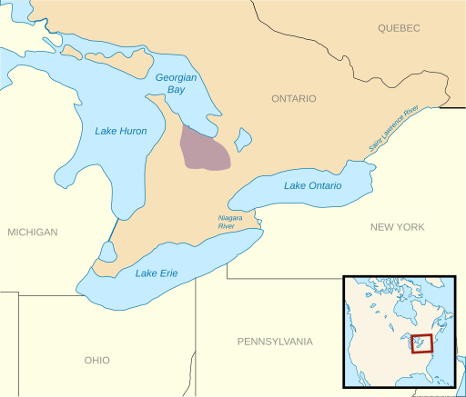
Description: Map of Petun territory This file was derived from: Anglo American War 1812 Locations map-fr.svg by Sémhur Information from https://mspace.lib.umanitoba.ca/bitstream/handle/1993/4175/julian_charles.pdf;jsessionid=F6F118DC79D313E74452CCEF75F89756?sequence=1
Title: Petun map
Credit: Own work
Author: Noahedits
Usage Terms: Creative Commons Attribution-Share Alike 4.0
License: CC BY-SA 4.0
License Link: https://creativecommons.org/licenses/by-sa/4.0
Attribution Required?: Yes
Image usage
The following page links to this image:

All content from Kiddle encyclopedia articles (including the article images and facts) can be freely used under Attribution-ShareAlike license, unless stated otherwise.