
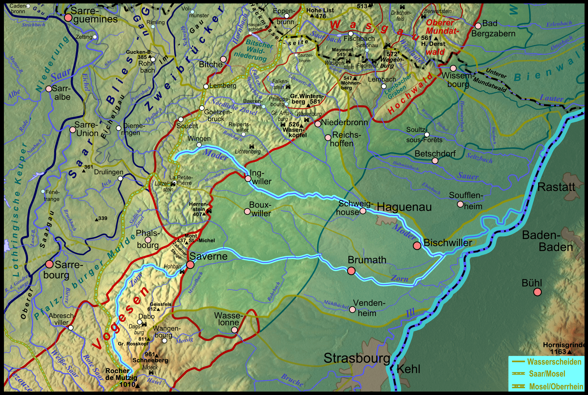
Image: Pfaelzerwaldkarte Flussgebiete Moder
Size of this preview: 800 × 538 pixels. Other resolutions: 320 × 215 pixels | 2,284 × 1,537 pixels.
Original image (2,284 × 1,537 pixels, file size: 5.04 MB, MIME type: image/png)
Description: Karte des Flussgebietes des elsässischen Rhein- Nebenflusses Moder; der südliche Hauptarm Zorn ist ebenfalls hervorgehoben.
Title: Pfaelzerwaldkarte Flussgebiete Moder
Credit: Own work New relief: maps-for-free, bonded using AutoStitch
Author: Elop
Usage Terms: GNU Free Documentation License
License: GFDL
License Link: http://www.gnu.org/copyleft/fdl.html
Attribution Required?: Yes
Image usage
The following page links to this image:

All content from Kiddle encyclopedia articles (including the article images and facts) can be freely used under Attribution-ShareAlike license, unless stated otherwise.