
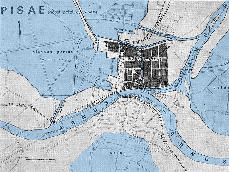
Image: Pisa Map V century a.C.
Size of this preview: 799 × 599 pixels. Other resolutions: 320 × 240 pixels | 2,238 × 1,679 pixels.
Original image (2,238 × 1,679 pixels, file size: 2.51 MB, MIME type: image/jpeg)
Description: Hypotetic map of Pisa in V century a.C.. The watersides are been highlighted to show why Pisa was a maritime city.
Title: Pisa Map V century a.C.
Credit: Own work
Author: LoneWolf1976
Usage Terms: Creative Commons Attribution-Share Alike 3.0
License: CC BY-SA 3.0
License Link: http://creativecommons.org/licenses/by-sa/3.0
Attribution Required?: Yes
Image usage
There are no pages that link to this image.

All content from Kiddle encyclopedia articles (including the article images and facts) can be freely used under Attribution-ShareAlike license, unless stated otherwise.