
Image: Pisa Map XI century b.C.
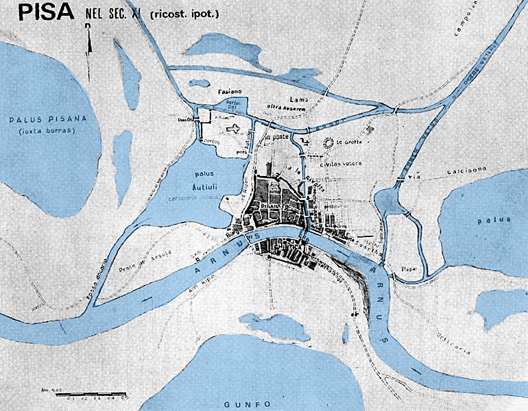
Description: Hypothetical map of Pisa in the eleventh century AD After the fall of Roman Empire, the city was highly reduced in extension, but since the 11th century it begun to grow again due to the powerful maritime dominion. Water has been considerably reduced in the centuries, but the river Auser (on the north) is still navigable with barges. The south part of the city (south of river Arno) wasn't actually the city, but a satellite town for commerce. The northern part was rounded with walls.
Title: Pisa Map XI century b.C.
Credit: Own work
Author: LoneWolf1976
Usage Terms: Creative Commons Attribution-Share Alike 3.0
License: CC BY-SA 3.0
License Link: http://creativecommons.org/licenses/by-sa/3.0
Attribution Required?: Yes
Image usage
There are no pages that link to this image.
