
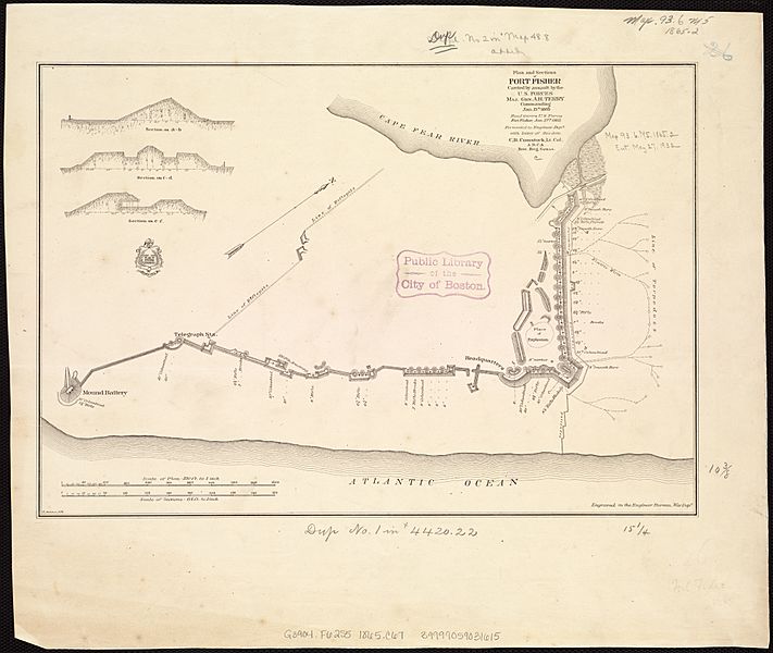
Image: Plan and sections of Fort Fisher, carried by assault by the U.S. forces, Maj. Gen. A.H. Terry commanding, Jan. 15th, 1865 (5960830325)

Description: Zoom into this map at maps.bpl.org. Author: Comstock, Cyrus Ballou Publisher: United States. War Dept. Engineer Dept. Date: 1865 Location: Fort Fisher (N.C. : Fort) Dimension: 27x39cm Scale: [1:3,840] Call Number: G3904.F62S5 1865 .C67
Title: Plan and sections of Fort Fisher, carried by assault by the U.S. forces, Maj. Gen. A.H. Terry commanding, Jan. 15th, 1865 (5960830325)
Credit: Plan and sections of Fort Fisher, carried by assault by the U.S. forces, Maj. Gen. A.H. Terry commanding, Jan. 15th, 1865 Uploaded by tm
Author: http://maps.bpl.org
Usage Terms: Creative Commons Attribution 2.0
License: CC BY 2.0
License Link: https://creativecommons.org/licenses/by/2.0
Attribution Required?: Yes
Image usage
The following page links to this image:

.jpg)