
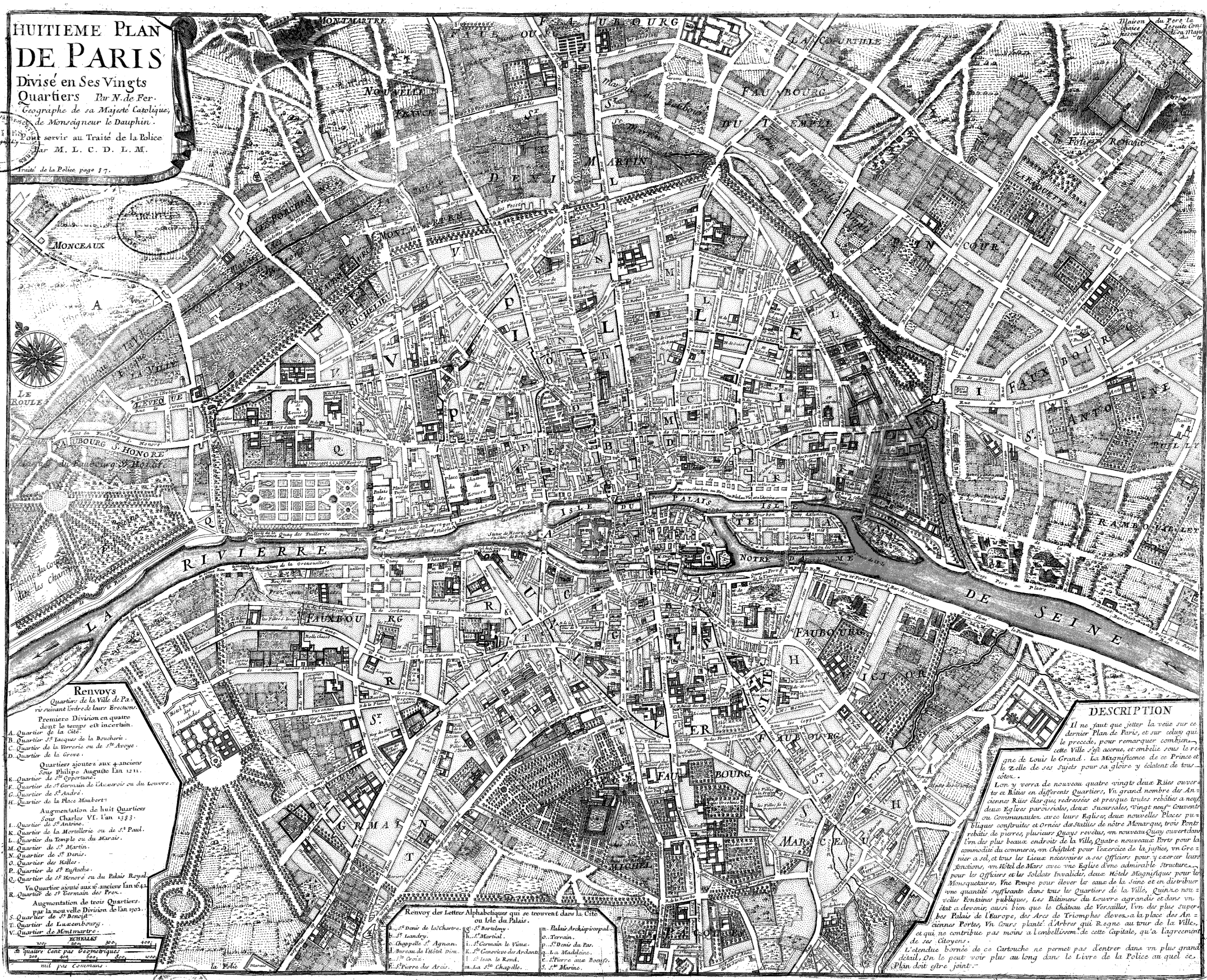
Image: Plan de Paris 1705 BNF07710700
Size of this preview: 739 × 600 pixels. Other resolutions: 296 × 240 pixels | 3,890 × 3,158 pixels.
Original image (3,890 × 3,158 pixels, file size: 7.08 MB, MIME type: image/png)
Description: Map of Paris in 1705, one of eight chronological maps of Paris from Traité de la police
Title: Plan de Paris 1705 BNF07710700
Credit: Gallica
Author: Nicolas de Fer
Usage Terms: Public domain
License: Public domain
Attribution Required?: No
Image usage
The following page links to this image:

All content from Kiddle encyclopedia articles (including the article images and facts) can be freely used under Attribution-ShareAlike license, unless stated otherwise.