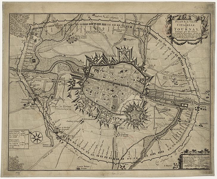
Image: Plan de Tournai 1709

Size of this preview: 729 × 600 pixels. Other resolutions: 292 × 240 pixels | 9,788 × 8,050 pixels.
Original image (9,788 × 8,050 pixels, file size: 15.72 MB, MIME type: image/jpeg)
Description: Plan du siège de Tournai en 1709.
Title: Plan de la ville et citadelle de Tournai assiégée par les alliés.
Credit: This file comes from Gallica Digital Library and is available under the digital ID btv1b8444606z
Author: Unknown authorUnknown author
Permission: Public domain works must be out of copyright in both the country of origin and the United States, and must be accompanied one or more valid copyright tags to indicate its status. Absence of such tags may result in a file's deletion.
Usage Terms: Public domain
License: Public domain
Attribution Required?: No
Image usage
The following page links to this image:

All content from Kiddle encyclopedia articles (including the article images and facts) can be freely used under Attribution-ShareAlike license, unless stated otherwise.
