
Image: Plan de la baie d alger situee sur la cote d afrique expedition barcelo 1783

Size of this preview: 800 × 554 pixels. Other resolutions: 320 × 222 pixels | 5,101 × 3,532 pixels.
Original image (5,101 × 3,532 pixels, file size: 10.23 MB, MIME type: image/jpeg)
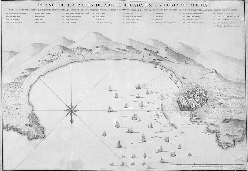
Description: Plano de la bahía de Argel, situada en la costa de África: Explicación del ataque que executó en esta Bahía el Exmo. Señor Don Antonio Barceló, siendo su Mayor General el Capitán de Navío Don Joseph Lorenzo de Goycoechea, a principios de agosto de 1783. Grabado por D. Tomas Lopez, Geógrafo del Rey. Madrid 1783.
Title: Plan de la baie d alger situee sur la cote d afrique expedition barcelo 1783
Credit: http://bibliotecadigital.rah.es/dgbrah/i18n/consulta/registro.cmd?id=12983
Author: Tomás López (1730-1802)
Usage Terms: Public domain
License: Public domain
Attribution Required?: No
Image usage
The following page links to this image:

All content from Kiddle encyclopedia articles (including the article images and facts) can be freely used under Attribution-ShareAlike license, unless stated otherwise.