
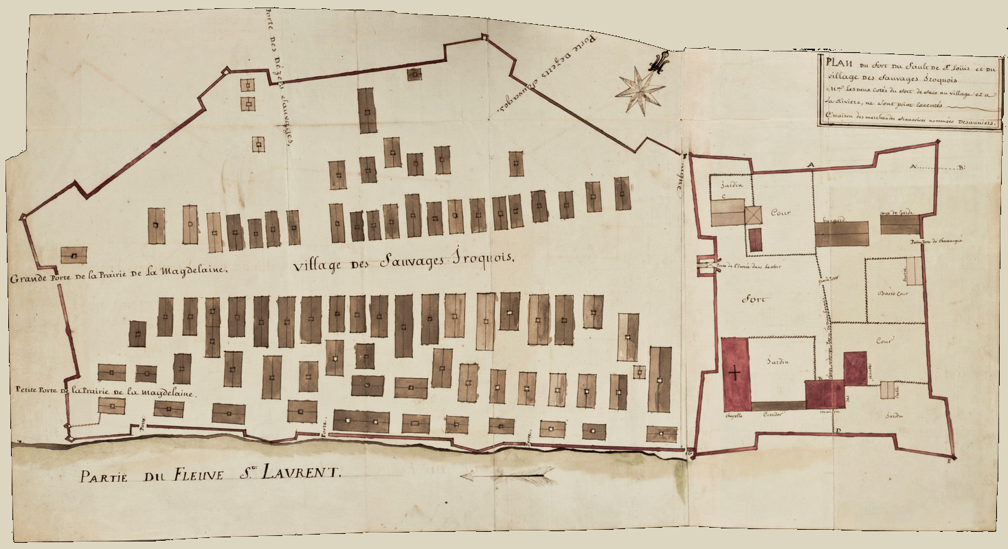
Image: Plan du Fort du Sault de St. Louis et du village des sauvages Iroquois
Size of this preview: 800 × 436 pixels. Other resolutions: 320 × 175 pixels | 1,467 × 800 pixels.
Original image (1,467 × 800 pixels, file size: 694 KB, MIME type: image/png)
Description: Plan of fort and mission at Kahnawake (previously known as Caughnagawa), south of Montréal on the Saint Lawrence River at Lake St. Louis. Detached from a contemporary manuscript copy of French military engineer Louis Franquet's Voyage du Canada, 1752.
Title: Plan du Fort du Sault de St. Louis et du village des sauvages Iroquois
Credit: collections.leventhalmap.org
Author: Louis Franquet
Usage Terms: Public domain
License: Public domain
Attribution Required?: No
Image usage
The following page links to this image:

All content from Kiddle encyclopedia articles (including the article images and facts) can be freely used under Attribution-ShareAlike license, unless stated otherwise.