
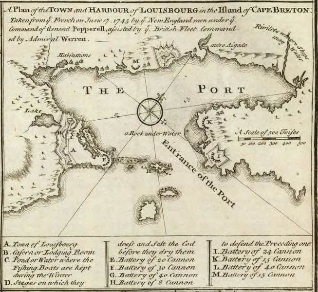
Image: Plan du siege de Louisbourg 1745

Size of this preview: 653 × 600 pixels. Other resolutions: 261 × 240 pixels | 712 × 654 pixels.
Original image (712 × 654 pixels, file size: 112 KB, MIME type: image/jpeg)
Description: Map of the siege of Louisbourg in 1745.
Title: Plan du siege de Louisbourg 1745
Credit: Archives anglaises : nmm.ac.uk
Author: Auteur inconnu
Usage Terms: Public domain
License: Public domain
Attribution Required?: No
Image usage
The following page links to this image:

All content from Kiddle encyclopedia articles (including the article images and facts) can be freely used under Attribution-ShareAlike license, unless stated otherwise.