
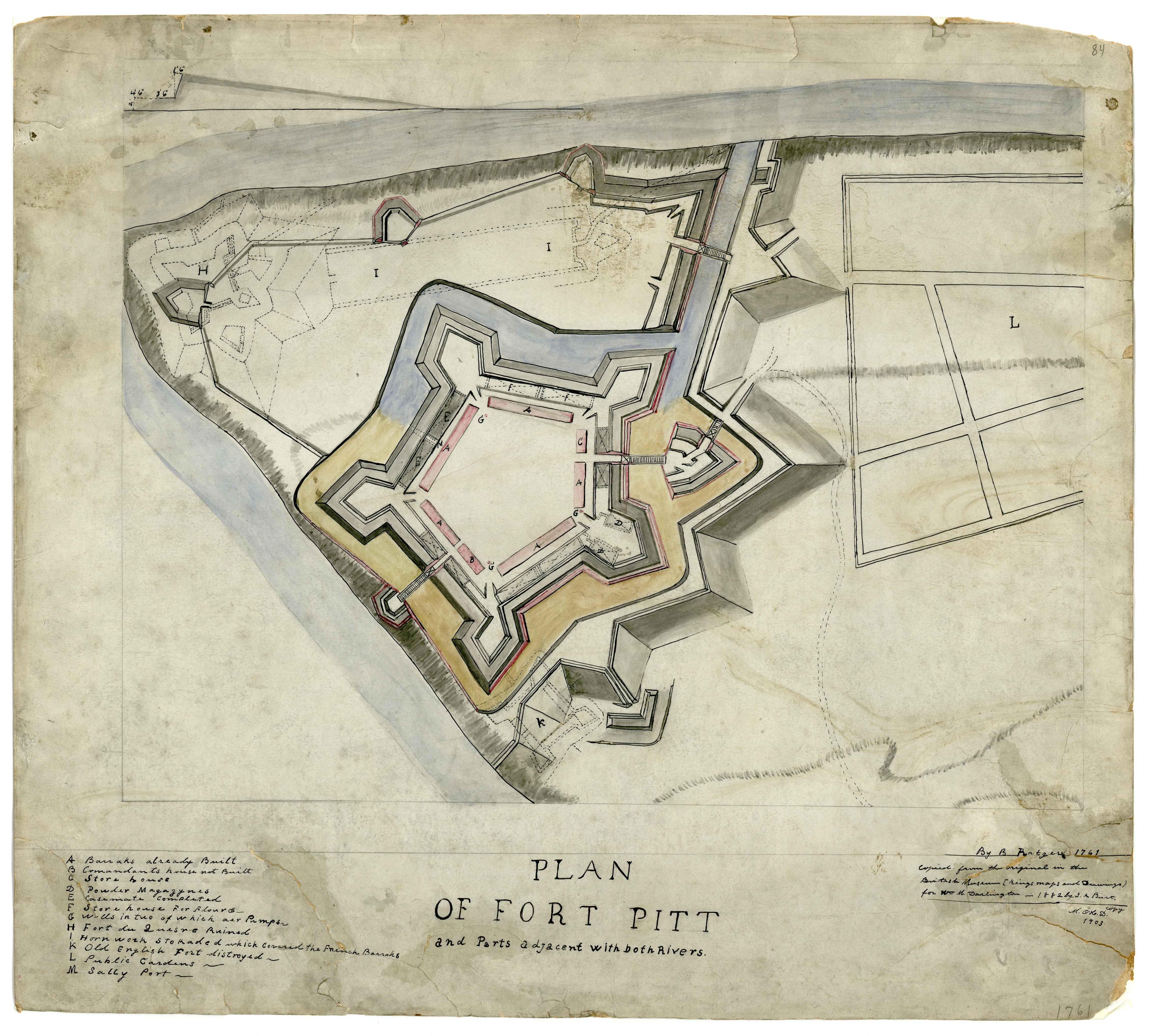
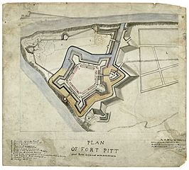
Image: Plan of Fort Pitt, 1761
Description: This is a plan of w:Fort Pitt published in 1861. Description from the Darlington Digital Library: Title: Plan of Fort Pitt and parts adjacent … Date: 1761 Creator: Ratzer, Bernard. Description: Plan of Fort Pitt and parts adjacent with both rivers. Manuscript Map. Copied from the orginial in the British Library (Kings' maps and drawings) for Wm. Darlington by J. A. Burt, 1882. M. O'H. D. copy 1903. Also showing, in dotted line, the earlier French Fort Duquesne. Subjects: Fort Pitt (Pa.)--Maps, Manuscript.; Fort Duquesne (Pa.)--Maps, Manuscript.; Pennsylvania--Maps, Manuscript.; United States--History--French and Indian War, 1755-1763--Maps, Manuscript.; Allegheny County (Pa.)--Maps, maunscript.; Maps, Manuscript.; Burt, J Dimension: 50 x 56 cm Scale: 1:3,050 Identifier: DARMAP0213
Title: Plan of Fort Pitt, 1761
Credit: Darlington Digital Library
Author: Bernard Ratzer
Usage Terms: Public domain
License: Public domain
Attribution Required?: No
Image usage
The following page links to this image:
