
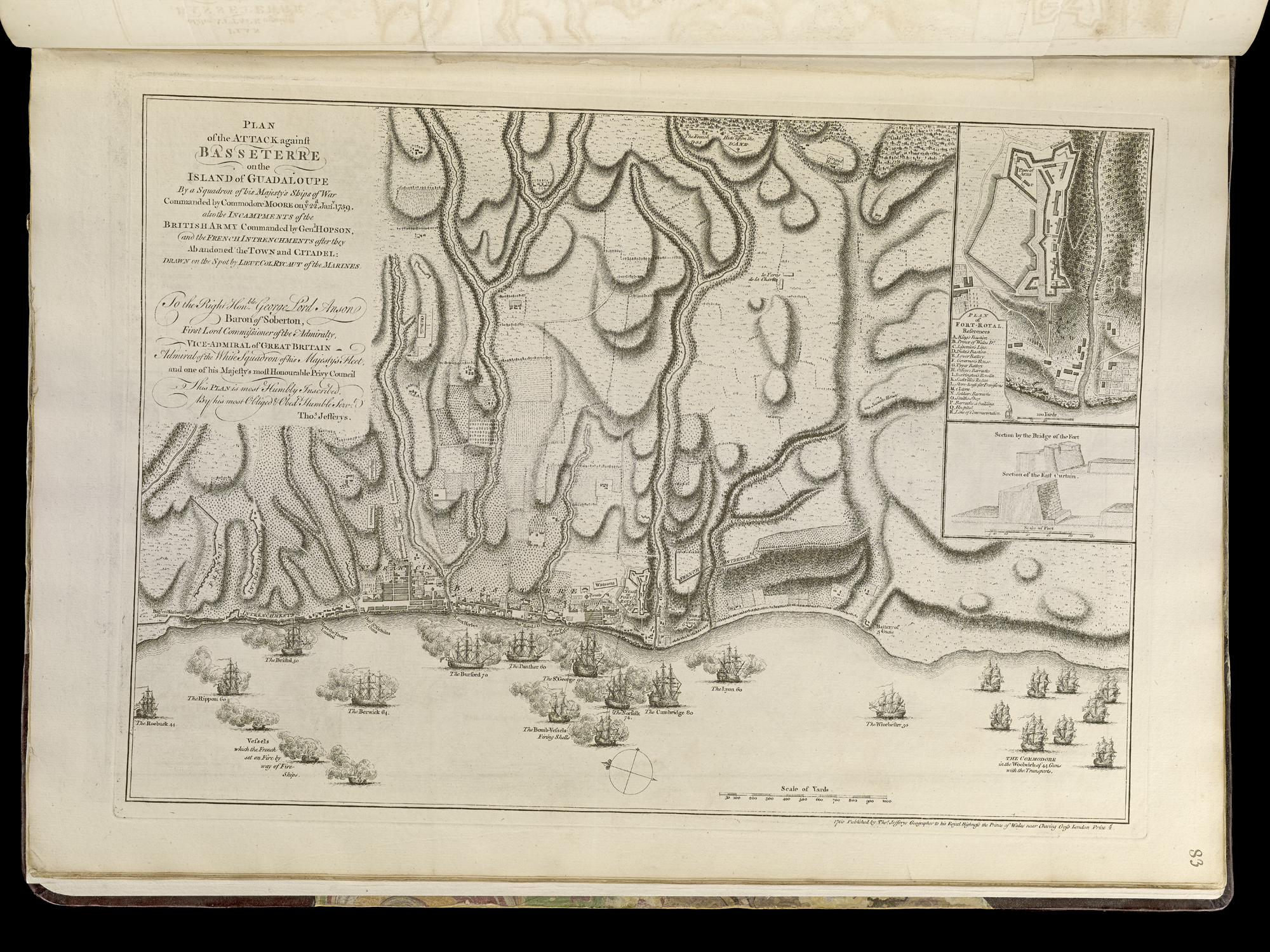
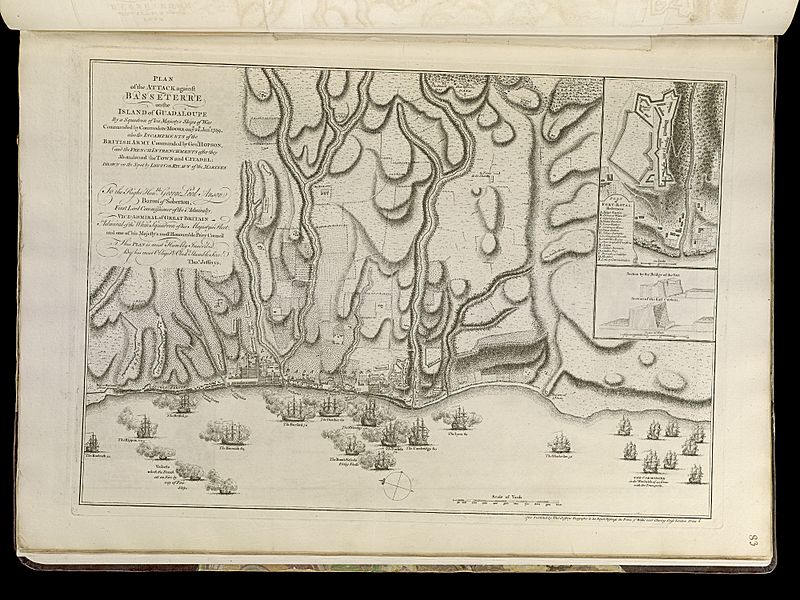
Image: Plan of the attack against Basseterre on the island of Guadeloupe by a squadron of his Majesty's ships of war commanded by Commodore Moore on ye 22d Jan. 1759 - also the incampments of the British (17727584474)
Description: Zoom into https://collections.leventhalmap.org/search/commonwealth:q524n536h at http://maps.bpl.org. Publisher: Jefferys, Thomas, Sayer, Robert after Lieut Col.l Edward Rycaut RM (d. 1763) (surveyor) Date: 1768 Dimensions: 32 x 47 cm. Scale: [ca. 1:11,700] Reference: Phillips. List of maps of America, p. 136 Reference: Phillips, 1196 Call Number: G1105 .J4 1768 Identifier: 4000137_0109r Barcode: 30000003256623 Norman B. Leventhal Map Center at the BPL
Title: Plan of the attack against Basseterre on the island of Guadeloupe by a squadron of his Majesty's ships of war commanded by Commodore Moore on ye 22d Jan. 1759 - also the incampments of the British (17727584474)
Credit: https://www.flickr.com/photos/normanbleventhalmapcenter/17727584474/
Author: Thomas Jefferys
Permission: At the time of upload, the image license was automatically confirmed using the Flickr API. For more information see Flickr API detail.
Usage Terms: Public domain
License: Public domain
Attribution Required?: No
Image usage
The following page links to this image:

.jpg)