
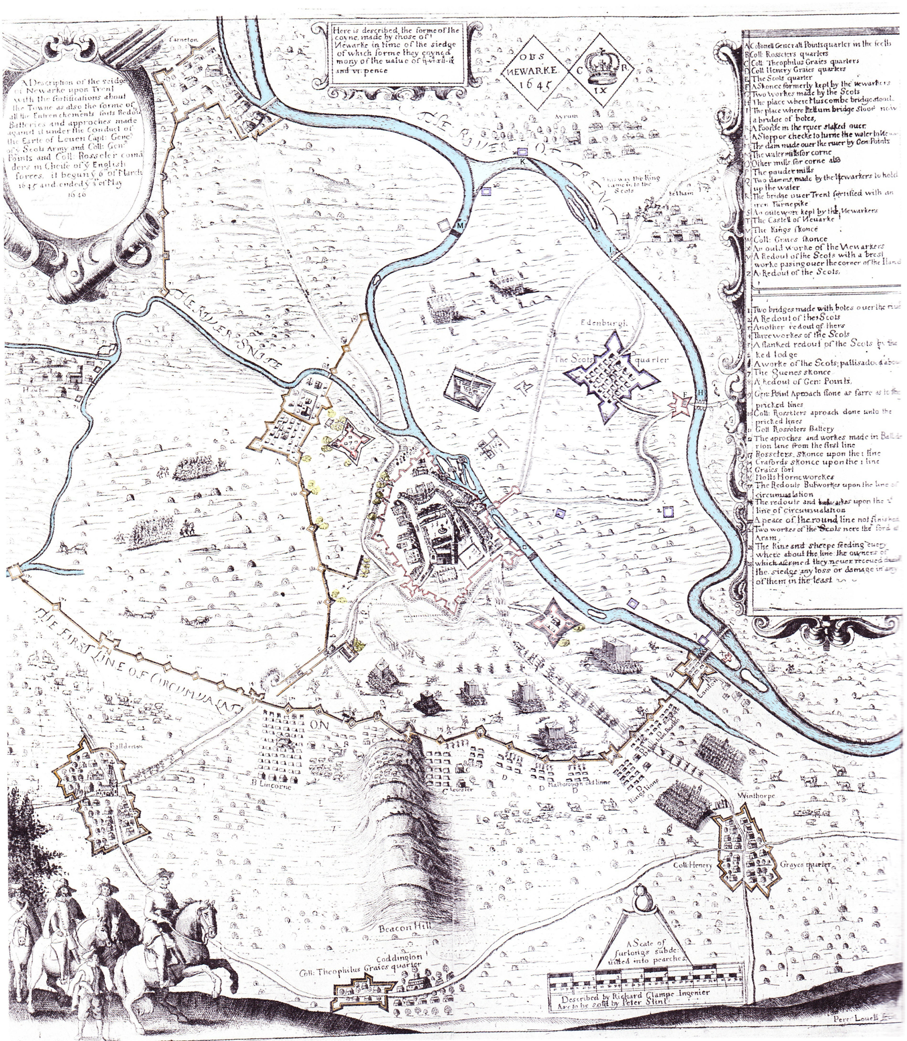
Image: Plan of the siege of Neward (1646) p. 222
Description: A plan of the Royalist defensive fortifications around Newark-on-Trent; the English Parliamentary and Scottish lines of circumvallation and their fortified encampments; at the siege of Newark in 1646 towards the end of the First English Civil War
Title: Plan of the siege of Neward (1646) p. 222
Credit: Pollard, Pollard; Oliver, Oliver (2002) Two Men in a Trench: Battlefield Archaeology - The Key to Unlocking the Past, Michael Joseph Ltd, ISBN 978-0718144746, page 222 Extract from Clampe's map of the siege of Newark 1645 to 1646
Author: Taken by their Chief Engineer during that transaction from whose drawing this is correctly copied and has been compared with the remains of the said place by Samuel Buck. June 1725. R Clampe delin. 1646. S. Buck, sculp 1726.
Usage Terms: Public domain
License: Public domain
Attribution Required?: No
Image usage
The following page links to this image:

_p._222.jpg)