
Image: Plan paris gerards1908 jms
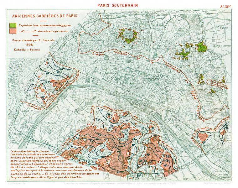
Description: Former Mines of Paris English (en): Underground gypsum exploitations Underground limestone exploitations Map drafted by Émile Gérards 1908 Scale: 1:60,000 Limite extrême de la formation de gypse exploitable : Extreme limit of exploitable gypsum deposits Limite de la zone exploitable du calcaire grossier : Exploitable limestone deposit zone limits Zone d'erosion et de brouillage : Erosion zone having no distinct geological formations Courbes de niveau d'après les repères antérieurs à 1907 (à diminuer de 0m61) : Elevation curves based on pre-1907 markers (to be reduced by .61 metres) Text : "The blue curves indicate the altitude at which the topmost extremity of the rock formation is generally exposed to the surface in the upper level of mine exploitations - This (limestone) deposit's thickness varies from .40 metres to 1 metre - The lower level of a (limestone) mine most often begins around 4 metres below the rock formation surface - Gypsum mine levels are too varied to be represented by curves"
Title: Plan paris gerards1908 jms
Credit: Own work
Author: Plan: Émile Gérards (1859–1920) BnF Notice d'autorité personne Digital copy: ThePromenader
Usage Terms: Public domain
License: Public domain
Attribution Required?: No
Image usage
The following page links to this image:
