
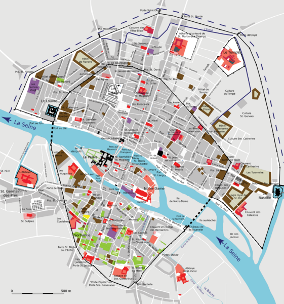
Image: Plan restitué de Paris en 1380 - ALPAGE

Size of this PNG preview of this SVG file: 561 × 600 pixels. Other resolution: 224 × 240 pixels.
Original image (SVG file, nominally 2,403 × 2,570 pixels, file size: 511 KB)
Description: Map of Paris in 1380 after Leuridan J., Mallet J.-A, Plan restitué de Paris en 1380, Paris, CNRS Editions, 1991, 1999.
Title: Plan restitué de Paris en 1380
Credit: Analyse diachronique de l'espace urbain Parisien: Home · Info · Image
Author: Cédric Roms, UMR 8589, Laboratoire de Médiévistique Occidentale de Paris.
Usage Terms: Creative Commons Attribution 2.0 fr
License: CC BY 2.0 fr
License Link: https://creativecommons.org/licenses/by/2.0/fr/deed.en
Attribution Required?: Yes
Image usage
The following page links to this image:

All content from Kiddle encyclopedia articles (including the article images and facts) can be freely used under Attribution-ShareAlike license, unless stated otherwise.