
Image: Plano de la Isla de Puerto Rico con el alumbrado maritimo, c. 1885

Size of this preview: 800 × 483 pixels. Other resolutions: 320 × 193 pixels | 5,413 × 3,270 pixels.
Original image (5,413 × 3,270 pixels, file size: 672 KB, MIME type: image/jpeg)
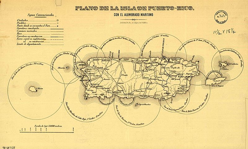
Description: uncolored lithographic print – Original layout of the Lighthouses as Planned by the Spanish prior to their Construction
Title: Map of the island of Puerto Rico indicating the maritime lighting
Credit: http://hdl.loc.gov/loc.gmd/g4971p.ct000347
Author: Lit. Boletin Mercantil
Usage Terms: Public domain
License: Public domain
Attribution Required?: No
Image usage
The following 2 pages link to this image:

All content from Kiddle encyclopedia articles (including the article images and facts) can be freely used under Attribution-ShareAlike license, unless stated otherwise.