
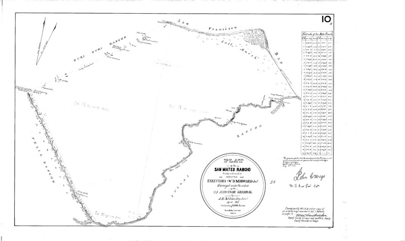
Image: Plat of San Mateo Rancho 1857
Size of this JPG preview of this TIF file: 800 × 476 pixels. Other resolution: 320 × 190 pixels.
Original image (12,224 × 7,274 pixels, file size: 284 KB, MIME type: image/tiff)
Description: Rancho San Mateo extended from the foothills of the Santa Cruz Mountains to San Francisco Bay. It included Coyote Point, about one-half the present city of San Mateo, all of Burlingame and most of Hillsborough
Title: Plat of San Mateo Rancho 1857
Credit: San Mateo County Property Maps Portal
Author: J. E. Addison
Usage Terms: Public domain
License: Public domain
Attribution Required?: No
Image usage
The following page links to this image:

All content from Kiddle encyclopedia articles (including the article images and facts) can be freely used under Attribution-ShareAlike license, unless stated otherwise.