
Image: Points of Interest in Third Winchester
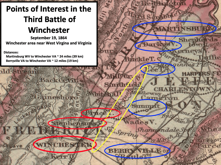
Description: Map shows where the Union (blue) and Confederate (red) troops were as they were preparing for the Third Battle of Winchester (a.k.a. Opequon) in the American Civil War. (This is an 1876 map, and the railroad that runs through Winchester ended at Winchester in 1864.)
Title: Points of Interest in Third Winchester
Credit: This is a portion of an 1876 map created by G.W. & C.B. Colton & Co. The entire map can be found in the Library of Congress here, and shows Virginia and West Virginia. Circles were added by TwoScarsUp based on mentions in the book "The Last Battle of Winchester: Phil Sheridan, Jubal Early, and the Shenandoah Valley Campaign, August 7-September 19, 1864." by Scott C. Patchan. Blue circles were held by the Union at the beginning, while red were held by the Confederates.
Author: G.W. & C.B. Colton published map in 1876, modifications by TwoScarsUp in 2020. G.W. Colton died in 1901, and C.B. Colton died in 1916 according to RareMaps.com.
Usage Terms: Public domain
License: Public domain
Attribution Required?: No
Image usage
The following page links to this image:
