
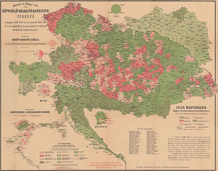
Image: Political map of the Ausgleich

Size of this preview: 763 × 600 pixels. Other resolutions: 306 × 240 pixels | 1,582 × 1,243 pixels.
Original image (1,582 × 1,243 pixels, file size: 360 KB, MIME type: image/jpeg)
Description: Political map of the Ausgleich. Electoral districts with majority of the A-H compromise supporter parties are in green. Electoral districts with majority against the A-H compromise are in red/purple. The map is based on the Austrian general elections between 1885-1889, and the Hungarian parliamentary elections between 1884-1887.
Title: Political map of the Ausgleich
Credit: https://m.blog.hu/pa/pangea/image/monarchia.jpg
Author: Count Béla Kreith and Gustav Freytag
Usage Terms: Public domain
License: Public domain
Attribution Required?: No
Image usage
There are no pages that link to this image.

All content from Kiddle encyclopedia articles (including the article images and facts) can be freely used under Attribution-ShareAlike license, unless stated otherwise.