
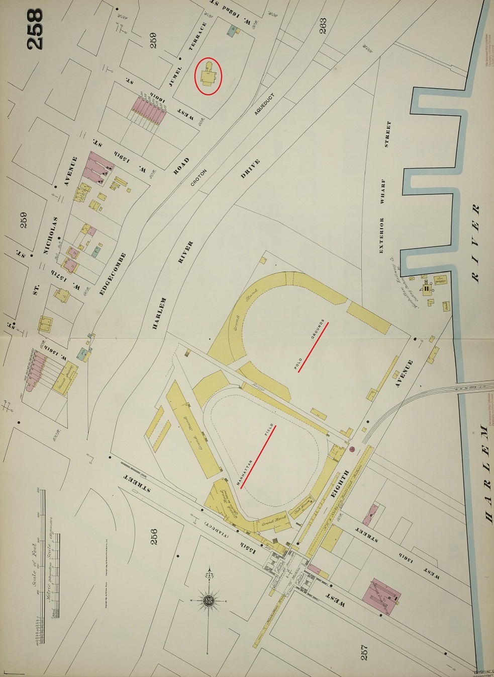
Image: Polo Grounds and Manhattan Field 1893
Size of this preview: 438 × 599 pixels. Other resolutions: 175 × 240 pixels | 983 × 1,345 pixels.
Original image (983 × 1,345 pixels, file size: 338 KB, MIME type: image/jpeg)
Description: Sanborn map of the Polo Grounds and surroundsings in 1893. Combined, rotated to true north, then altered slightly for readability. The circled building is the w:Morris–Jumel Mansion, which still stands.
Title: Polo Grounds and Manhattan Field 1893
Credit: Library of Congress. [1] and [2]
Author: Sanborn Map Company, 1890 - 1902 Vol. 11
Usage Terms: Public domain
License: Public domain
Attribution Required?: No
Image usage
The following page links to this image:

All content from Kiddle encyclopedia articles (including the article images and facts) can be freely used under Attribution-ShareAlike license, unless stated otherwise.