
Image: PortRoyalEarthquakeMap

Size of this preview: 800 × 572 pixels. Other resolutions: 320 × 229 pixels | 948 × 678 pixels.
Original image (948 × 678 pixels, file size: 219 KB, MIME type: image/jpeg)
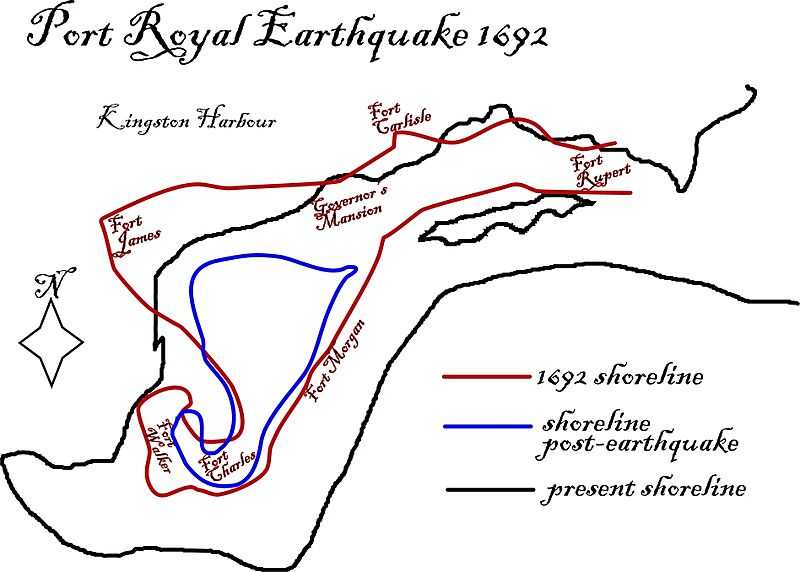
Description: Map showing shoreline changes caused by the 1692 Port Royal earthquake
Title: PortRoyalEarthquakeMap
Credit: Own work, based on information from the The College of Wooster
Author: I184.147.120.196
Permission: This work has been released into the public domain by its author, I184.147.120.196. This applies worldwide. In some countries this may not be legally possible; if so: I184.147.120.196 grants anyone the right to use this work for any purpose, without any conditions, unless such conditions are required by law.
Usage Terms: Public domain
License: Public domain
Attribution Required?: No
Image usage
The following page links to this image:

All content from Kiddle encyclopedia articles (including the article images and facts) can be freely used under Attribution-ShareAlike license, unless stated otherwise.