
Image: Porter1796WesternReserve-300

Size of this preview: 800 × 534 pixels. Other resolutions: 320 × 213 pixels | 7,403 × 4,937 pixels.
Original image (7,403 × 4,937 pixels, file size: 6.67 MB, MIME type: image/jpeg)
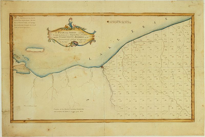
Description: A Plan of the Survey made by & under the direction of Augustus Porter upon the Connecticut-Reserve for the Connecticut Land Company in the Year 1796. Showing the Western Reserve divided into sections and the town and city of Cleaveland (Cleveland)
Title: Porter1796WesternReserve-300
Credit: William L. Clements Library (University of Michigan)
Author: Augustus Porter
Usage Terms: Public domain
License: Public domain
Attribution Required?: No
Image usage
The following 2 pages link to this image:

All content from Kiddle encyclopedia articles (including the article images and facts) can be freely used under Attribution-ShareAlike license, unless stated otherwise.