
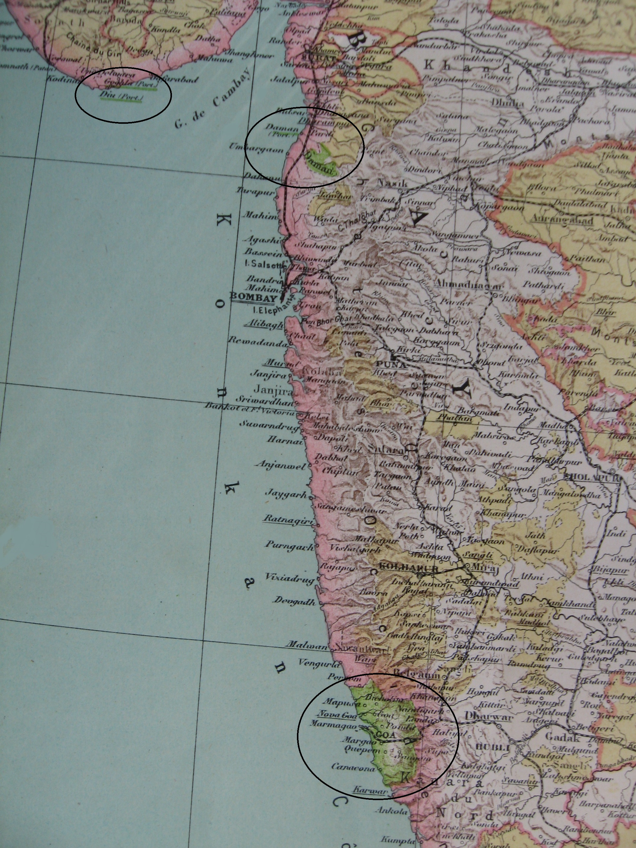
Image: Portuguese India 1923
Description: 1923 map of India over which the Portuguese possessions have been highlighted. During the last two centuries of its existence, Portuguese India was made of three separate districts: Goa (under which name the whole colony was often called); Daman, which included the port city of Daman and the two inland enclaves of Dadra and Nagar Haveli (indicated simply as "Daman" on the map); and Diu. Cropped from a map of India included in the Atlas universel de géographie published by Hachette in 1923.
Title: Portuguese India 1923
Credit: Own work
Author: Lubiesque
Usage Terms: Creative Commons Attribution-Share Alike 3.0
License: CC BY-SA 3.0
License Link: https://creativecommons.org/licenses/by-sa/3.0
Attribution Required?: Yes
Image usage
The following page links to this image:
