
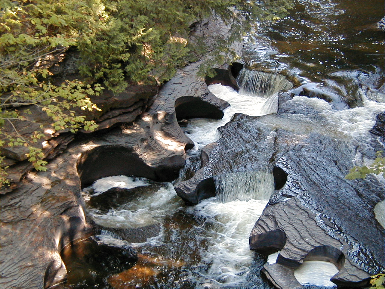
Image: Potholes (Presque Isle River, Porcupine Mountains State Park, Upper Peninsula of Michigan, USA) (21466113862)
Description: The rounded pits are potholes - some of the best I've ever seen. Potholes principally form by abrasive erosion by sediments (sand & gravel) moving in eddies within pre-existing bedrock depressions. The rocks are dark-colored mudshales of the Precambrian-aged Nonesuch Shale. Stratigraphy: Nonesuch Shale, middle Oronto Group, upper Keweenawan Supergroup, upper Mesoproterozoic Locality: lower Presque Isle River, Porcupine Mountains State Park, Upper Peninsula of Michigan, USA
Title: Potholes (Presque Isle River, Porcupine Mountains State Park, Upper Peninsula of Michigan, USA) (21466113862)
Credit: Potholes (Presque Isle River, Porcupine Mountains State Park, Upper Peninsula of Michigan, USA)
Author: James St. John
Usage Terms: Creative Commons Attribution 2.0
License: CC BY 2.0
License Link: https://creativecommons.org/licenses/by/2.0
Attribution Required?: Yes
Image usage
The following page links to this image:

_(21466113862).jpg)