
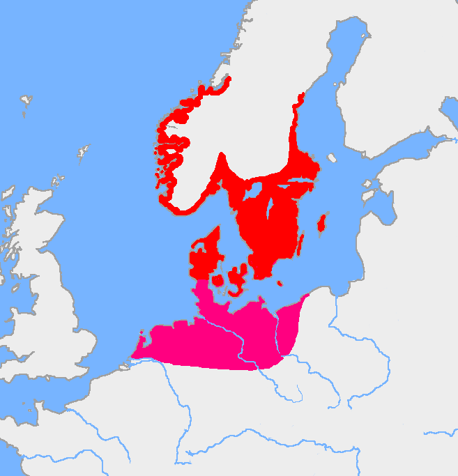
Image: Pre-roman iron age (map)
Size of this preview: 577 × 600 pixels. Other resolutions: 231 × 240 pixels | 657 × 683 pixels.
Original image (657 × 683 pixels, file size: 28 KB, MIME type: image/png)
Description: Map of the Nordic Iron Age and the Jastorf culture.
Title: Pre-roman iron age (map)
Credit: Image:Europe plain rivers.png and the Harper Atlas of World History (ed. Vidal-Naquet) in Swedish translation: Atlas över mänsklighetens historia.
Author: Copied from en:, uploaded by Wiglaf
Usage Terms: Public domain
License: Public domain
Attribution Required?: No
Image usage
The following page links to this image:

All content from Kiddle encyclopedia articles (including the article images and facts) can be freely used under Attribution-ShareAlike license, unless stated otherwise.
.PNG)