
Image: Prelude to Battle of White Sulphur Springs Aug 24
Size of this preview: 800 × 597 pixels. Other resolutions: 320 × 239 pixels | 929 × 693 pixels.
Original image (929 × 693 pixels, file size: 445 KB, MIME type: image/png)
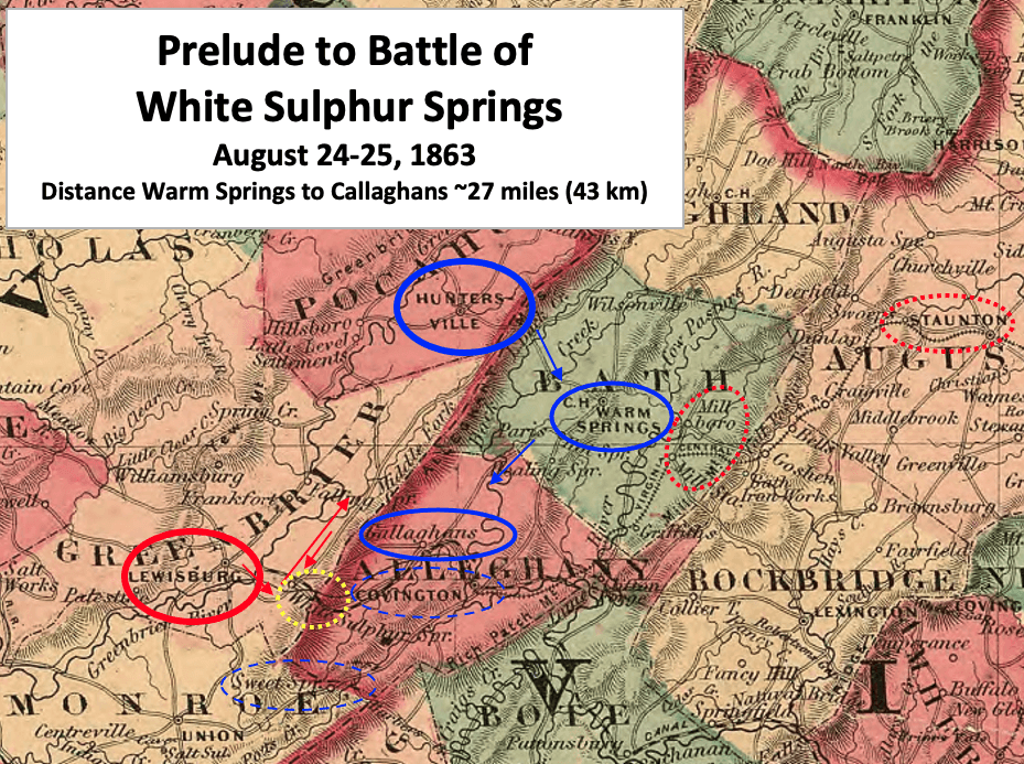
Description: This map shows the two days of movements by Br. Gen. William W. Averell's before Battle of White Sulphur Springs in August 1863 during the American Civil War.
Title: Prelude to Battle of White Sulphur Springs Aug 24
Credit: This is a crop of an 1864 map created by Alvin Jewett Johnson. The entire map can be found in the Library of Congress here, and shows Virginia, Delaware, Maryland & West Virginia. Text box and arrows etc. were added by TwoScarsUp based on William W. Averell's September 1, 1863 report in Official Records XXIX p. 33.
Author: Alvin Jewett Johnson (1827-1884)
Usage Terms: Public domain
License: Public domain
Attribution Required?: No
Image usage
The following page links to this image:

All content from Kiddle encyclopedia articles (including the article images and facts) can be freely used under Attribution-ShareAlike license, unless stated otherwise.