
Image: Prospect hill new haven

Size of this preview: 458 × 600 pixels. Other resolutions: 183 × 240 pixels | 575 × 753 pixels.
Original image (575 × 753 pixels, file size: 288 KB, MIME type: image/png)
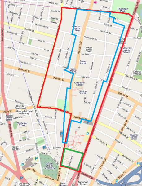
Description: Boundary of Prospect Hill neighborhood planning area (red) and approximate boundary of Prospect Hill Historic District (blue). Also shown is approximate boundary for Hillhouse Avenue Historic District (green). Actual edges of historic districts follow irregularities of individual property lines. Not shown is boundary for Whitney Avenue Historic District which includes properties within right edge of Prospect Hill planning area. Data from City of New Haven City Plan Department. Imagery from OpenStreetMap.
Title: Prospect hill new haven
Credit: Own work
Author: Polaron at English Wikipedia
Usage Terms: Public domain
License: Public domain
Attribution Required?: No
Image usage
The following 2 pages link to this image:

All content from Kiddle encyclopedia articles (including the article images and facts) can be freely used under Attribution-ShareAlike license, unless stated otherwise.