
Image: Rǫgnvaldr Guðrøðarson (map 2)

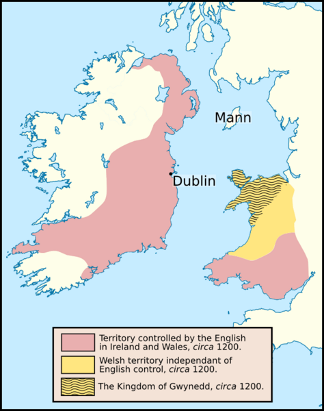
Description: This map depicts the area of English control in Ireland and Wales in about 1200. Also shown is the Welsh Kingdom of Gwynedd, and the location of Mann in relation to this Welsh kingdom. I based this map off two published in the following books: Page xxii of: Turvey, R. (2002). The Welsh princes: the native rulers of Wales, 1063–1283. Longman. ISBN 0 582 30811 9. Page 71 of: Davies, R. R. (2000). The first English empire: power and identities in the British Isles, 1093–1343. ISBN 0-19-820849-9.
Title: Rǫgnvaldr Guðrøðarson (map 2)
Credit: Own work. I created this image using Inkscape. I used the following file, created by NordNordWest: File:United_Kingdom_location_map.svg.
Author: Brianann MacAmhlaidh
Usage Terms: Creative Commons Attribution-Share Alike 3.0
License: CC BY-SA 3.0
License Link: https://creativecommons.org/licenses/by-sa/3.0
Attribution Required?: Yes
Image usage
The following page links to this image:

.png)